 |||
|||

 map
6
map
6
This is a revised draft of the Hampstead Neighbourhood Plan. The first version was passed by public referendum in 2018, and currently forms part of the development plan within the London Borough of Camden. This means that decision makers, when determining planning applications within the Plan area, must have regard to its policies.
In 2022, the committee of the Hampstead Neighbourhood Forum decided that it was time to make sure that the Plan was up to date and still reflected the wishes of people living in Hampstead. In particular, we thought that it should reflect the intensification of changes to the climate, which makes it even more essential to discourage the use of fossil fuels and to develop more sustainably. This new draft, of a new Hampstead Neighbourhood Plan 2025-2040, is the result.
Just as with the existing Plan, the overall aim is to promote Hampstead’s future as a lively and contemporary neighbourhood with exceptional heritage and unique open spaces. Among the changes are new policies to promote sustainability in development, and to enhance the biodiversity networks that are so important to a green area such as Hampstead.
The Hampstead Neighbourhood Forum consists entirely of volunteers. Since 2014, we have consulted repeatedly and extensively with residents, businesses and other stakeholders in Hampstead. This document is thus the product of ten years of work by many volunteers, and is based on the input of hundreds of local people.
The Forum would like to thank everyone who has helped produce this revised draft, including committee members and advisers past and present, and our local Councillors. Deborah McCann and Clare Hamman made important contributions. We are very grateful to Andrew Triggs, Brian O’Donnell and Nicola Tulley at Camden for their guidance and support.
Alexander Nicoll
Chair, Hampstead Neighbourhood Forum
Evidence base
Open Spaces, Biodiversity Corridors and Ecological Networks
Hampstead Local Green Spaces evidence
List of veteran and important local trees
List of important local views
Additional evidence for Local Greens Spaces and biodiversity corridors
Map 1: Hampstead Neighbourhood Plan Area
Map 2: Character areas
Map 3: Conservation areas
Map 4: Views
Map 5: Biodiversity corridors, Local Green Spaces, veteran trees – new map
Map 6: Ecological networks — new map, including links to wider area
Map 7: Hampstead bedrock geology
Map 8: Areas of landslip potential
Map 9: PTAL scores
Vision: Our vision is to conserve and foster Hampstead’s charm and liveability by protecting the distinctive character of buildings and open spaces, the Heath, healthy living, community spirit and the local economy, while also increasing sustainability, mitigating climate change and enhancing the natural environment.
The main aims of our Neighbourhood Plan, which we also refer to as the Plan, have consistently received strong support in community consultations since the Neighbourhood Forum was established in 2014. They are to ensure that Hampstead is:
Lively and contemporary, while safeguarding the fine heritage of streets and buildings.
Promoting sustainability and energy efficiency, in order both to mitigate and adapt to the climate emergency.
Enduringly green, with the Heath, open spaces, trees and landscapes well protected.
Safe and walkable, with good public transport and alternatives to use of cars.
Business-friendly — to meet needs of residents, workers and visitors and back local enterprise.
A community with good amenities, a sense of belonging and mutual support.
Design and heritage: Development must respond to the history and distinctive character of Hampstead’s different areas. It must contribute positively through good, sustainable building design and environmentally sound landscaping. These norms apply to new developments and retrofitting of existing structures, as well as to the streetscape. However, it is recognised that the demands of sustainability and energy efficiency may sometimes challenge considerations of heritage, and that a balance or synthesis may then need to be reached.
Natural Environment: The Plan supports development that fosters strong ecological networks, biodiversity and the environment, helping to mitigate the impact of climate change. Development on the fringes of the Heath must be sensitive to the setting of the Heath.
Basements: The Plan requires basement proposals to demonstrate that neighbours and the local environment will be protected from harm.
Traffic and transport: The Plan supports development that reduces motor vehicle traffic, improves public transport and promotes alternatives such as cycling and walking. The Plan seeks to limit the environmental impact of heavy goods vehicles.
Economy: The Plan supports development that encourages a healthy retail mix. This means broadening the range of shops and eating and drinking places and supporting the retention of business premises and small and independent shops. Shopfronts and signage should reflect the heritage, and their designs should be sensitive to the streetscape.
Housing and Community: The Plan supports the improvement of community facilities, particularly those that serve older people and those with disabilities. . It backs development that promotes affordable housing and resists loss of housing units. It supports local cultural activities.
Policy DH1: Design
Policy DH2: Conservation areas and listed buildings
Policy DH3: Sustainable development
Policy DH4: Clean and considerate construction
Policy DH5: The urban realm
Policy NE1: Supporting biodiversity
Policy NE2: Ecological networks and biodiversity corridors
Policy NE3: Local Green Spaces
Policy NE4: Trees
Policy BA1: Basement Development
Policy BA2: Construction Management Plans
Policy TT1: Traffic volumes and vehicle size
Policy TT2: Pedestrian environments
Policy TT3: Public transport
Policy TT4: Cycle and car ownership
Policy EC1: Healthy retail mix
Policy EC2: Contributing positively to the retail environment
Policy HC1: Housing mix
Policy HC2: Community facilities
Policy HC3: Enhancing street life through the public realm
This is a Neighbourhood Plan created by the people of Hampstead. Our area is unique in terms of its history, its astonishing variety of buildings, and its open spaces. By creating a Neighbourhood Plan, Hampstead’s community gained greater influence over the area’s future development. This Plan can help to ensure that changes will address the community’s needs while also preserving and enhancing Hampstead’s special character as a place to live and work.
 A person standing in front of a crowd of people Description automatically generated
A Neighbourhood Plan is an opportunity for local people to have greater influence over the management of change. Hampstead has been changing constantly since its first farm was established more than a thousand years ago. It will continue to do so. How do we want our buildings to develop in the future? How do we make sure that our amenities are protected and improved?
The Localism Act of 2011 established the authority for local communities to develop a shared vision “to deliver the sustainable development they need”. They could do this by setting up a Neighbourhood Forum, which would then write a Neighbourhood Plan. Each forum was required to consult widely to ensure that its policies reflected local wishes and aspirations. It had to show that it had done so, and that its plan was based on robust evidence. Each plan must pass examination by an independent examiner, meet the basic conditions set forth in the legislation and be approved in a public referendum before it is “made”, or adopted, by the local authority — in this case, the London Borough of Camden.
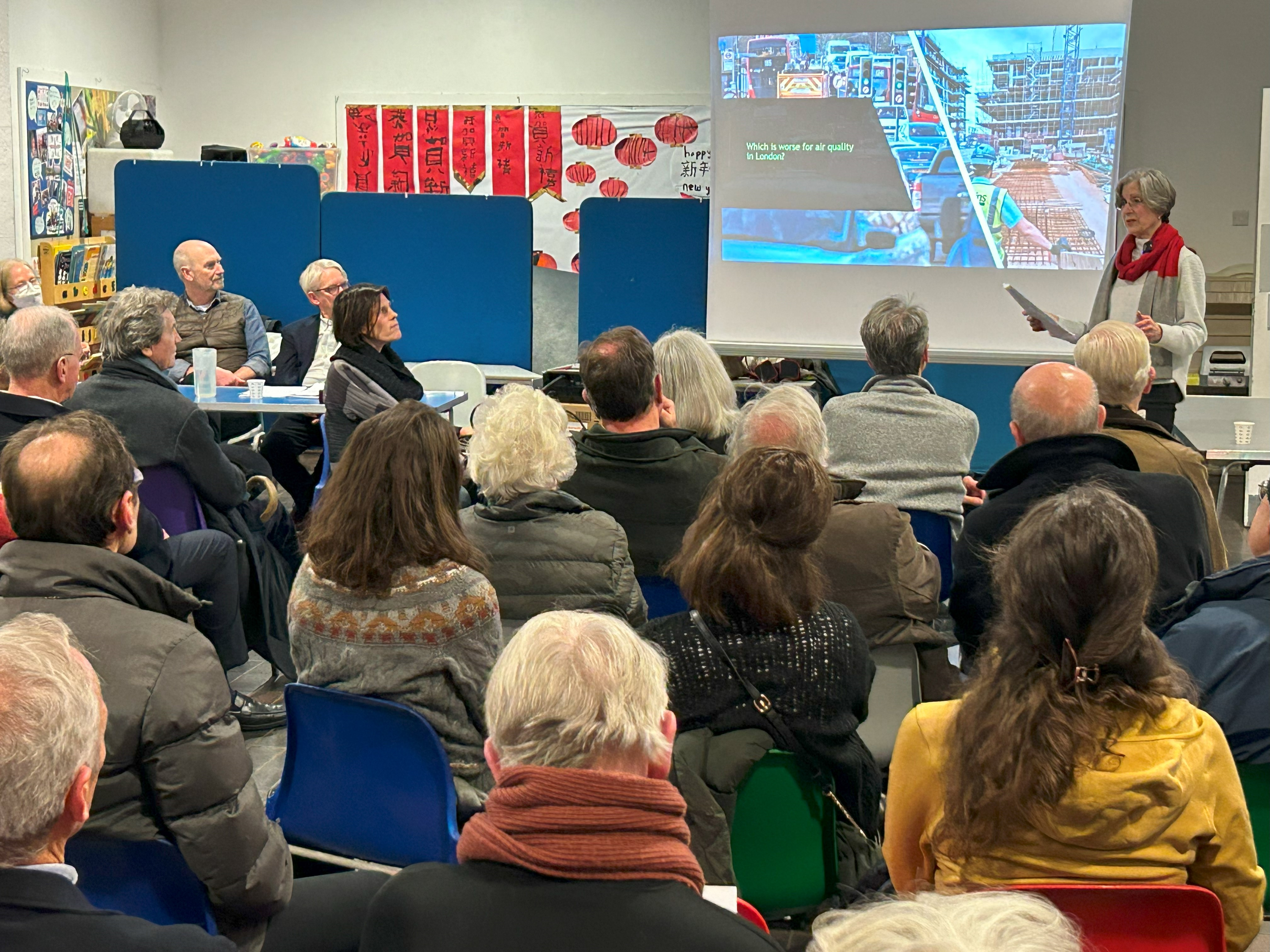
The Hampstead Neighbourhood Forum is made up of volunteers from the local community. The idea grew out of a series of meetings that culminated in our first annual general meeting in March 2014, when a constitution was adopted and a committee elected. Our application to Camden Council to be designated as a neighbourhood forum was approved in October 2014, and again in October 2019 after the end of the first five-year term. The Forum’s committee and advisers wrote the Neighbourhood Plan with the help of many local people and businesses who offered their thoughts and expertise. The Forum has also undertaken projects that are in accordance with the Plan’s policies, such as testing air quality.
After the Plan was approved in a referendum and formally accepted in 2018, the Forum adopted a mission statement that involves monitoring the relevance and performance of the Plan, preparing revisions and fostering discussion on issues of importance to local residents. Subsequently, the Forum’s committee felt that some elements of the existing Plan could be strengthened, and so began a new process of public consultation. This revised Plan is the result.
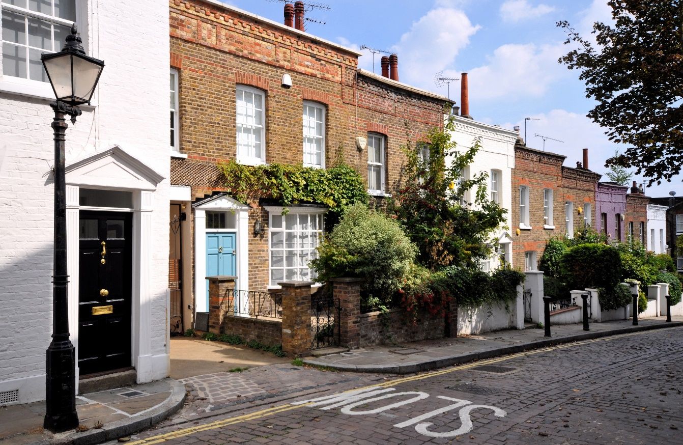
Hampstead is an attractive place to live in and to visit. Its centre retains the character of a historic village even though it is just a few miles from the centre of London. The area’s extensive development since the 17th Century has managed to retain harmony with the beautiful landscape of Hampstead Heath. In short, Hampstead is flourishing, and is loved by its residents.
However, it faces a number of pressures. A strong property market brings constant demand for development, which requires careful management if the aspects that residents love about Hampstead are to be maintained. As in other parts of London, property owners wish to expand available space and enhance values. This can challenge preservation of the area’s unique heritage. Excessive traffic is a concern, especially because it worsens air quality in an area with many schools and green spaces. So too is the lack of facilities for cyclists. Residents are keen to protect green spaces, and especially Hampstead Heath itself. They want to be sure that their area has a strong sense of community, in particular ensuring that there are proper services for all, including senior residents.
Meanwhile, the need for sustainability and energy efficiency has intensified significantly as government and local planning policies have put increasing emphasis on ways of mitigating and adapting to climate change. The urgency of reducing dependence on fossil fuels was highlighted by the 2022 jump in energy prices following the invasion of Ukraine. Flooding has occurred more frequently within the Forum area and to areas that receive both surface run-off and groundwater from the Plan Area.
All these priorities are reflected in the development policies in this revised Hampstead Neighbourhood Plan.
The area is fortunate to be supported by a network of planning controls that help it to flourish while keeping its unique nature. It has strong Conservation Area Appraisals and Management Strategies. Hampstead Heath itself is well cared for by the Corporation of London and is safeguarded by Metropolitan Open Land legislation. A vigilant community has done its best over more than 200 years to ward off efforts by developers to encroach upon the Heath. Camden itself has strong planning rules and the London Plan sets forth a vision for the whole of the metropolitan area. Underpinning all these plans is a robust National Policy Planning Framework (NPPF).
However, the Forum’s public consultations since 2014 have revealed particular concerns that this Neighbourhood Plan seeks to address in the policies set out in the sections that follow. They revolve around the demands created by climate change, and the need to combat, mitigate and adapt to it. While traffic is not in itself within the remit of a Neighbourhood Plan, it should be noted that consultations have consistently shown that it is top concern of Hampstead residents. The Plan therefore needs to take into account public desire to reduce car traffic and promote alternatives.
The Neighbourhood Forum held a series of public meetings in 2014. Clear themes emerged in the opinions that residents expressed. These views helped the Forum’s committee to draft a widely distributed vision statement including broad aims and objectives. The hundreds of responses that we received helped shape the first draft of the Neighbourhood Plan. Further consultations continued over the next three years. The Plan was supported by 91% of voters in a public referendum in June 2018 and was then adopted, or ‘made’, by Camden. The Plan proved effective in influencing planning applications and decisions. Since 2022, the Forum has engaged in further consultations and held public meetings to ensure that the Plan still reflected the wishes of residents. The result in this revised Plan was the strengthening of policies to put greater emphasis on sustainable building design, energy efficiency and biodiversity networks.
 A group of children looking at a map Description automatically generated
Year 6 children at Christ Church school taking part in a 2023 workshop on what they like and don’t like about their local area.
The Plan has the same legal status as the Camden Local Plan. It is part of the statutory development plan. Applications for planning permission must be determined in accordance with the development plan, unless material considerations indicate otherwise.
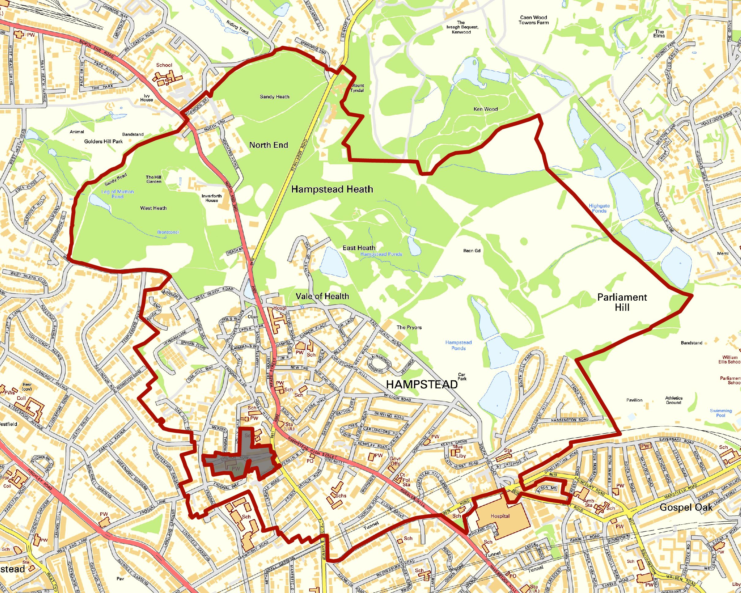

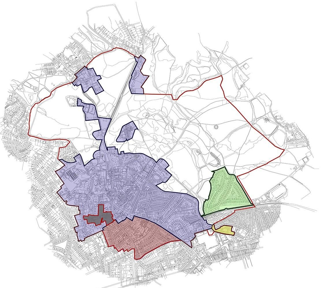
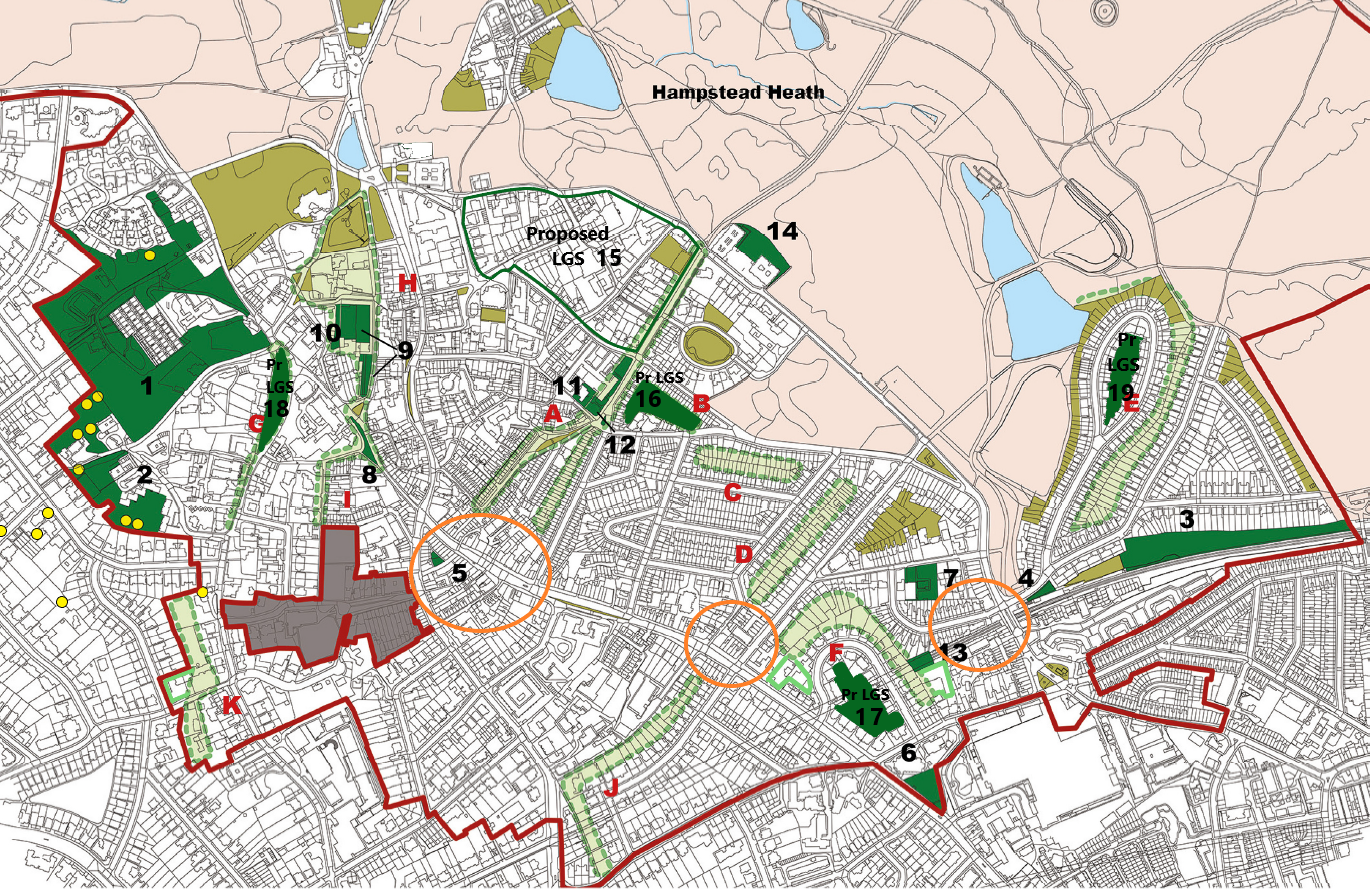
Map 1: Hampstead Neighbourhood Plan Area (grey area excluded)
The area covered by this Plan (see Map 1) includes Hampstead Town ward and a significant part of Frognal ward. It includes most of Hampstead Heath and a small part of Gospel Oak ward. It does not include Church Row and Perrin’s Walk.
The Plan Area contains about 10,600 residents in about 4,800 households. About 8,700 residents are over 16, of whom about 3,350 are over 60. About 66% of residents are economically active, and about 15% are retired. About 45% of households have no car. About three-quarters have gas-fired central heating. About half of residences are owned, about 40% privately rented and about 9% are social rented. (Note: These figures are not directly comparable to those in the Neighbourhood Plan of 2018. They are derived from the 2021 Census. However, they represent the addition of figures for Hampstead Town ward to an estimate by the Forum of households in other wards that are within the Plan area – essentially, about one-third of Frognal ward.)
What must the Plan do?
A Neighbourhood Plan’s policies must address the development and use of land. A Neighbourhood Plan can also include a vision, priorities, recommendations and information aimed at improving the neighbourhood going beyond development and land use issues, but these will lack the statutory force of the Plan’s policies.
Neighbourhood Plans must meet basic conditions set by the Town and Country Planning Act 1990. They must:
Have regard to national policy and guidance issued by the Secretary of
State.
Contribute to the achievement of sustainable development.
Be in general conformity with the strategic policies contained within the development plan for the area.
In our Basic Conditions Statement, as well as in our Evidence Base (Appendix 1), we have outlined how each policy meets these basic conditions and conforms to the National Planning Policy Framework, the Camden Local Plan and other relevant strategic policies.
2.18 Government guidance requires the Forum to make a statement about the modifications to a Neighbourhood Plan that is already in force. The Forum must state whether it believes on the one hand that the modifications are significant but do not substantially alter its nature – and therefore require inspection by an independent examiner; or alternatively, that the changes are large enough to alter the fundamental nature of the Plan — and therefore require both inspection and a public referendum. The Forum is required to state reasons for its opinion.
2.19 Accordingly, the Forum is submitting the following statement that both summarises the proposed changes to the Plan and argues that they remain true to the aims and goals of its predecessor.
 A church with a clock tower Description automatically generated
The hills on which Hampstead is located have shaped the character of its streets and buildings over the centuries. The dense cluster of streets and alleys around the High Street and Heath Street developed in an informal pattern and feature an eclectic mix of fine houses, cottages, and modern infill developments, while the grid-like later neighbourhoods, with more uniform terraces, were carved out of old estates by Victorian developers.
The Plan area contains few opportunities for large-scale development. The last of Hampstead’s manorial and private estates were developed in the late 19th and early 20th centuries, and considerable infill development has taken place ever since. The Camden Local Plan does not identify Hampstead as an area of significant growth. However, there are always opportunities for development to satisfy local housing and other needs. The Plan outlines ways that this can occur while protecting the area’s high level of amenity.
It is particularly important that development is carried out in a manner that both enhances the environment and keeps environmental damage to a minimum. Older housing, particularly that built before 1900, is particularly energy inefficient. London’s homes and workplaces produce approximately 78% of the city’s greenhouse gas emissions, according to the Mayor of London. The UK has a legally binding target to reach net zero by 2050, and at COP26 in 2021 the government committed to achieving a 68% reduction in greenhouse gas emissions by 2030. This Plan seeks to reduce emissions from housing and construction to contribute to achievement of this target.
According to the House of Commons Environmental Audit Committee’s 2022 report, Building to net zero: costing carbon in construction, retrofitting and reuse of existing buildings should be prioritised over new build to “conserve resources, minimise embodied carbon emissions, reduce demolition waste and deliver cost-effective solutions to delivering on housing demand”.
3.5 Air quality is also an important environmental concern. Fine particulates, the main pollutant emitted by burning solid fuels like wood, are widely acknowledged as being the air pollutant that has greatest impact on health. Development must not worsen air quality.
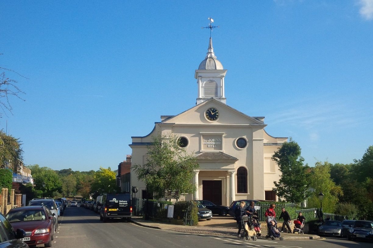
3.6 The Hampstead Neighbourhood Plan includes Hampstead and South Hill Park Conservation Areas, part of Fitzjohns/Netherhall Conservation Area and a very small part of Mansfield Conservation Area. (See Map 3 below). It is an area of immense historic interest and visual appeal, with diverse architecture, public spaces, outstanding natural beauty and wonderful views. The Forum area contains seven Grade I-listed properties (Burgh House, Fenton House, St Stephen’s Rosslyn Hill, St John’s Church Downshire Hill, Romney House, 6 Ellerdale Road and Keats House), as well as more than 20 Grade II* listed and hundreds of Grade II-listed properties and features.
 Map
2: Conservation areas
Map
2: Conservation areas
Note: the Hampstead Neighbourhood Forum does not include Church Row or Perrin’s Walk, as shown in the grey area above.
Hampstead Conservation Area
South Hill Park Conservation Area
Fitzjohns and Netherhall Conservation Area
Mansfield Conservation Area
Hampstead Neighbourhood Forum Boundary
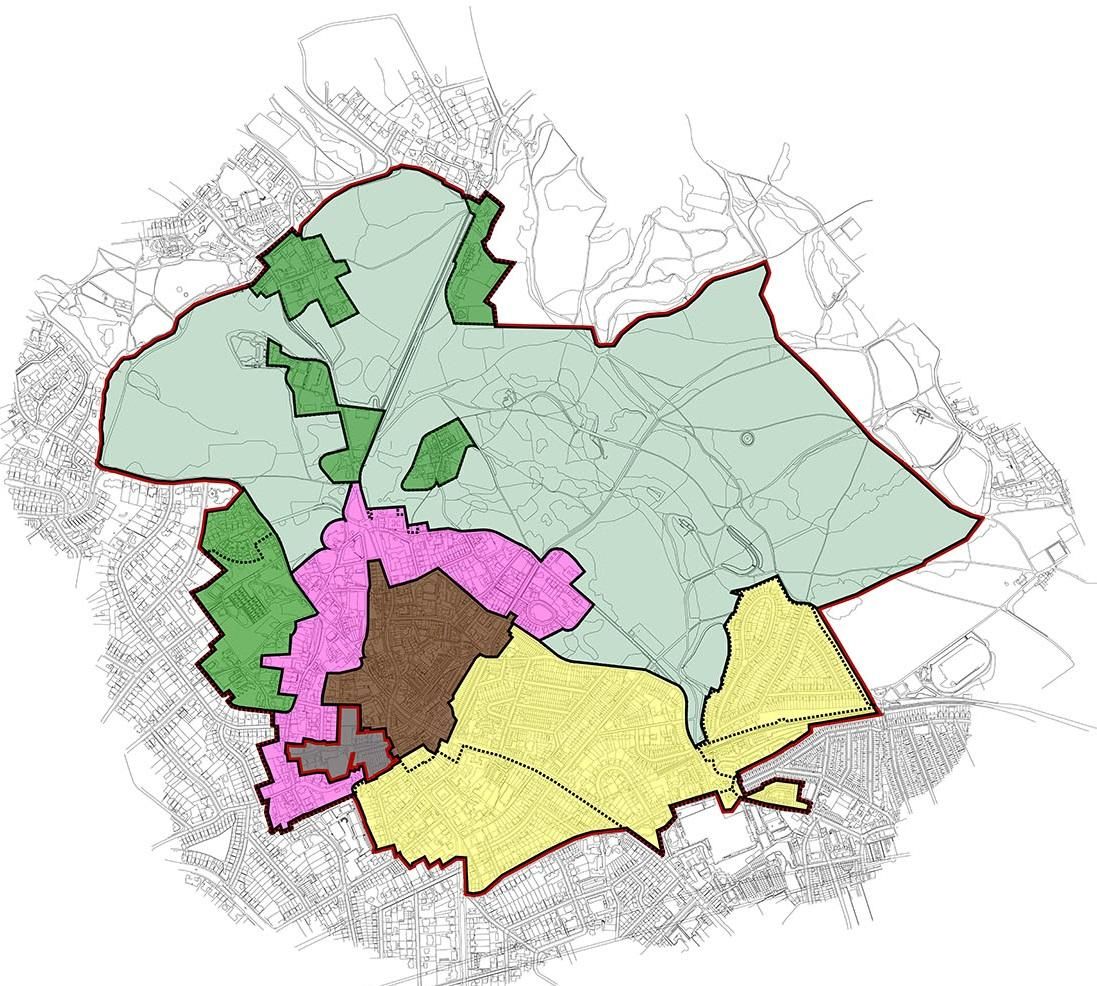
3.7 The Plan asks developers to further consider the “character areas”,
described below, which are distinguished not only by history and topography, but also by the “public aspect” of the buildings — the way that built form relates to landscape, open spaces and streets. These are outlined below.
 C:\Users\sowmya.parthasarathy\Desktop\Camden Maps\Character Areas Map\Character Area Map. lowresjpg.jpg
Map 3: Character areas
Note: the Hampstead Neighbourhood Plan Area does not include Church Row or Perrin’s Walk, as shown in the grey area above
Character area 1 — Village Core
Character area 2 — Outer Village
Character area 3 — 19th Century Expansion
Character area 4 — Outlying areas
Character area 5 — Hampstead Heath
Hampstead Neighbourhood Forum Boundary
3.8 These are brief descriptions of the five character areas:
The dense cluster of streets and alleys around the High Street and Heath Street developed in an informal pattern and feature an eclectic mix of fine houses, cottages and modern infill developments. Small office uses above retail make a positive contribution to the activity and viability of the area.
Clusters of small buildings create pockets of quirky charm and individuality; the area feels compact and urban. Picturesque and intimate pedestrian alleys generate surprise and delight; buildings are often set back behind railings or brick boundary walls, which frame and reinforce a dense and public network of routes and spaces. Gated developments stand out as an anomaly in this landscape, undermining the network of clear and inviting public routes through their overt message of private security.
Views over rooftops, historic towers, church spires and landmark buildings are a feature of the topography.
Stretching north around the dense village core is an area of imposing houses and buildings in a magnificent setting of mature gardens and fine trees. The lush landscape signals the presence of the Heath nearby. A few formal terraces create a more urban ensemble along the street. Some newer houses seem crammed onto sites that are too small for them while others, though large, respect their landscape setting.
Pedestrian routes through stepped alleys and informal pavements are prominent as are mature trees, both private and public.
Much of this area developed on estates and landholdings, resulting in a planned appearance with typical urban streets of varying density, mass, and scale. The transition from the public pavement to the private home through a semi-private space is a notable feature of these streets.
The Downshire Hill and Keats Grove area was the first to be developed from about 1815 with elegant Regency stucco villas and brick flat-fronted late Georgian terraced houses.
The shopping streets of South End Green were built in the late 1800’s, though Pond Street has many listed buildings from an earlier time. While it is a popular destination, excessive traffic undermines its character. Traffic congestion also mars Arkwright Road and Fitzjohn’s Avenue.
The distinguishing characteristic of these areas is their sense of being set within the Heath and mainly are of two types: self-contained older areas such the Vale of Health and North End and large mansions and gardens of the 20C developments such as Mount Tyndall, St Columba’s, Firecrest Drive, Oak Hill Park and Branch Hill, all built on what were the estates of large houses.
Overgrown greenery and mature landscapes are appropriate for the fringes of the Heath. Any development of the area must consider its location on the edge of the Heath and seek to preserve and enhance its lush open character.
The Heath is enormously important to the quality, character and natural environment of the Plan’s built areas. All development, particularly along the fringes of the Heath and areas that have a visual relationship and physical relationship with it, should minimise any impact on it.
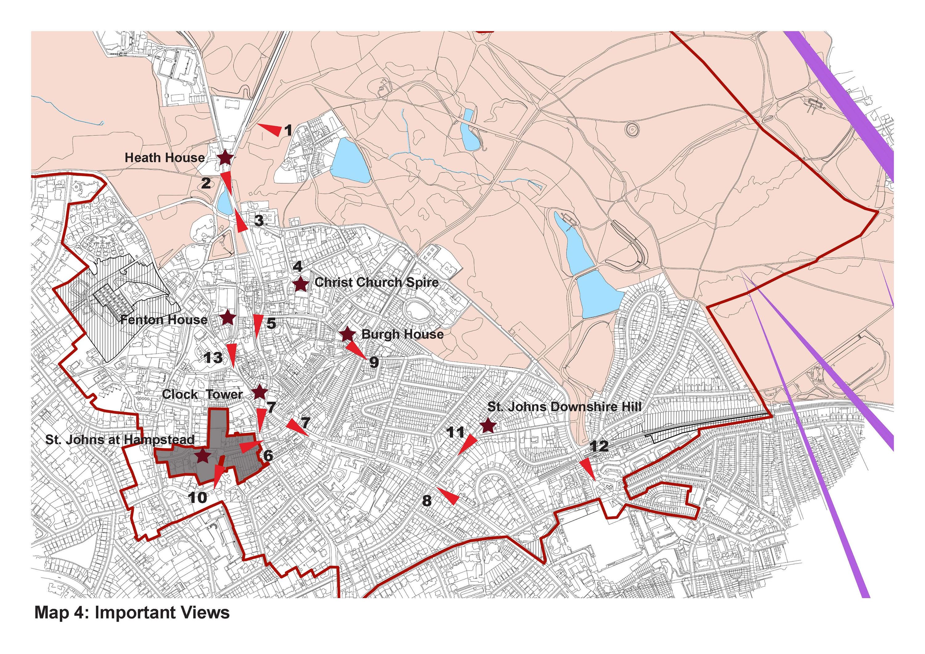
3.9 Development should not harm any of the numerous important historic and significant views in Hampstead, Hampstead Heath and in and out of the area. Two of these, Parliament Hill towards Westminster and towards St Pauls, form part of the London View Management Framework and are designated views on Camden’s Local Plan Policies Map. Map 4 below identifies some of the important views within the area as listed below. (See Appendix 7 for photographs and justifications).
Below Spaniards Road near Northern Fairgrounds, across Vale of Health
From Whitestone Pond north toward War Memorial, Jack Straw’s Castle, Heath House
From Whitestone Pond south down Heath Street
Christchurch spire from various points in area
Up Heath Street toward the Mount
From Heath Street to St John’s, Church Row
Toward Clock Tower from High Street and Heath Street
Down High Street toward Rosslyn Hill
Burgh House from Well Walk
Back of Church Row from Frognal Way
Down Downshire Hill toward the Heath
South End Green toward South End Road and entrance to Heath
View from Holly Bush/Frognal Rise toward Fenton House
 C:\Users\sowmya.parthasarathy\Desktop\View Map.jpg
Map 4: Views
Important Views
Landmarks
London View Corridors
3.10 As set forth by the NPPF, good design is a key aspect in the creation of high quality, beautiful and sustainable development. Good design functions well, is sympathetic to its setting, and creates places that are safe, inclusive, and accessible.
3.11 Where applicable, the design and access statement and the plans and elevations submitted as part of any planning application must explain and illustrate:
how the design considers the defined special character of the vicinity as described in the Plan and in relevant Conservation Area Appraisals and Management Strategies;
provide justification for the size and massing of the proposal including elevational elements (doors, windows, etc.) and the relationship to neighbouring buildings;
what factors led to a decision either to contrast with or, alternatively, to relate carefully to the surrounding buildings and urban character;
how the proposal relates to the surrounding roads, alleys etc. and contributes to the local urban character (see the Conservation Area Appraisals and Management Strategies and the Neighbourhood Plan);
the choice of materials, textures and colour;
how the proposal is designed to avoid loss or damage to trees and vegetation or relevant features;
in relevant schemes, provide justification for the boundary treatment and planting, particularly where this is visible from the street; and
how the design has considered access for those who might experience difficulties in using the space.
how the proposal will protect and enhance neighbour amenity. Amenity refers to the desirable or useful features and facilities of a property or neighbourhood that support day-to-day living. This includes access to daylight, sunlight, privacy, and outlook.
3.12 Permeability (the ability for an area to be walked or cycled through) is a desirable feature of all the character areas, especially within larger developments. It is important that these character areas remain permeable to support safe and secure walking and, where feasible, cycling. To help promote a more inclusive and sustainable community, gated forms of housing development will not be supported.
3.13 Boundary walls are an important feature of the character areas and treatment
of boundary walls, identifying materials and design, should be included in any planning application where changes are planned.
3.14 The Plan supports proposals that protect the amenity and privacy of neighbours. Proposals must demonstrate that the loss of light to neighbours will be acceptable according to Camden guidance.
3.15 Enclosures for wheelie bins should be sited in an unobtrusive area and screened from the street, if possible. Screen planting such as bushy shrubs or climbing plants is an excellent method that also increases biodiversity.
Policy DH2: Conservation areas and listed buildings
3.17 National planning policies require local plans to set forth a positive strategy for the “conservation and enjoyment of the historic environment.” The effect of a planning application on a listed asset (designated heritage asset) or an asset noted as making a positive contribution in the relevant Conservation Area Appraisals or are in Camden’s Local List (non-designated heritage asset) should be considered.
Harm to a designated or non-designated heritage asset would include development that through its height, mass, or quality, obstructs or degrades that asset or its setting.
Historic features are easily lost or compromised through development but development can prove positive by restoring historic features, particularly windows, doors, railings and gardens and, where appropriate, restoring painted brickwork to its original state. Development should follow the guidance given in the relevant Conservation Area Appraisals and Management Strategies and Camden Streetscape Design Manual.
Where there is potential for archaeological interest, measures should be put in place to cease work if the developer finds any archaeological artefacts during construction.
Development should maintain and enhance the historic street character of the immediate context through choice of façade materials, provision of setbacks where appropriate, boundary conditions, building entrances and plantings.
Where an applicant claims that no viable use of a heritage asset can be found and therefore proposes demolition, the applicant first will be required to market the heritage asset at fair market value to potential buyers for a medium period of time of five years.
New buildings should relate to the scale, density, mass and detail of the local character and use the highest quality materials. All development should contribute positively to the public realm and respond sympathetically to character of its immediate surroundings. This may be achieved through either traditional or contemporary architecture or a blend of the two.
Policy DH3: Sustainable development
The National Policy Planning Framework (NPPF) mandates that all plans must promote ‘a sustainable pattern of development’, including improving the environment and mitigating climate change. The NPPF also includes an environmental objective, which is to ‘protect and enhance our natural, built and historic environment; including making effective use of land, improving biodiversity, using natural resources prudently, minimising waste and pollution, and mitigating and adapting to climate change, including moving to a low carbon economy.’ Section 14 of the NPPF states that ‘the planning system should support the transition to a low carbon future in a changing climate, taking full account of flood risk and coastal change’.
According to the Mayor of London, housing and workplaces are responsible for approximately 78% of London’s carbon emissions. Improving the energy efficiency of all homes by minimising heat loss and maximising air tightness, combined with adequate ventilation, is critical to mitigating and being resilient to climate change.
Historic England, in its guidance document Energy Efficiency and Historic Buildings: How to Improve Energy Efficiency (2018), sets out a ‘whole building approach’ that ‘uses an understanding of a building in its context to find balanced solutions that save energy, sustain heritage significance, and maintain a comfortable and healthy indoor environment.’
Furthermore, Camden’s Clean Air Action Plan 2023-2026 highlights the extent to which construction sites contributes to air pollution, especially by particulates. This is one reason why retrofitting of existing buildings in energy-efficient ways can contribute to sustainable building design while directly reducing pollution.
The energy hierarchy (“Be Lean, Be Clean, Be Green”) prioritises energy efficiency, followed by renewable energy sources and sustainable practices, to minimise environmental impact and promote a cleaner and more sustainable energy system.
Retrofitting measures could include steps to reduce heat loss such as using energy efficient glazing in Conservation Areas or secondary or thermally efficient mono glazing in listed buildings with wooden windows that meet the latest relevant British standard. Other measures could include roof and sensitive interior wall insulation and the replacement of fossil fuel burning energy sources with electric power from renewable sources with zero air emissions locally, such as heat pumps.
Net zero carbon development is development that reduces greenhouse gas emissions through minimising both annual and peak energy demand by following the steps of the Energy Hierarchy. This should be at least equal to targets set out in the London Plan or Local Plan (whichever is the most recent).
Net energy positive means that over an average year, a development would produce more energy from renewable energy sources than it imports from elsewhere.
Exceptions to DH3 (1) would include cases where the building to be demolished is considered negative to the conservation area and where demolition has been justified in line with the Camden Local Plan.
Planning applications for new build should be supported where appropriate by a whole life carbon assessment. See the London Councils’ Low Carbon Development toolkit, which provides more detail on how developers can reduce the carbon intensity of their schemes. Whole Life Carbon Assessments will be required in line with the Local Plan and relevant Camden planning guidance.
Examples of low-carbon homes include, but are not limited to, construction to Passivhaus standards and conversion to EnerPHit standards. Passivhaus/EnerPHit standards, as well as similar standards (e.g., AECB standards), are recommended over point-based systems such as BREEAM and Home Quality Mark standards.
Major development, according to the London Borough of Camden, would include 10 or more houses or flats or buildings where the floor space to be created is 1,000 square metres or greater. Minor development is anything less than this.
New-build development is new construction as opposed to the renovation or refurbishment of existing structures. Retaining only a small fraction of the existing building, such as a façade, will be considered new-build development.
Trees play an important part in reducing carbon emissions. Cutting down trees or reducing tree canopies to facilitate cleaner energy would be counterproductive.
The green heating and cooling hierarchy emphasises energy conservation, followed by the utilisation of renewable energy sources and efficient technologies, to achieve environmentally friendly and sustainable heating and cooling systems. Heat pumps and solar collectors will be supported.
According to Camden guidance, a decentralised energy network is a way of distributing the heat (and more rarely, power) generated from a given energy source(s)across multiple buildings or, as Camden prefers, multiple sites.
All developments are to conform to Camden’s water efficiency standards. Developments that remove soil, as for foundations for extensions, basements, etc., should mitigate for loss of water absorption by use of attenuation tanks and/or by removing hardstanding elsewhere on site.
Policy DH4: Clean and considerate construction
Construction contributes considerably to air pollution, being responsible for 24% of PM10 emissions and 9% of PM2.5 emissions in the London Borough of Camden, according to https://www.camden.gov.uk/air-quality. Development activity also results in additional traffic, vibration, noise, light and dust that adversely affect both humans and domestic and wild animals.
To conserve the environment and promote the objectives of sustainable development a number of local planning authorities in London have established Codes of Construction Practice or Construction Management Templates that require contractors and landowners to register sites with the Considerate Constructors Scheme (“CCS”). Compliance is secured by planning obligation.
In London, Camden Council expects CCS registration as part of all Construction Management Plans. The Royal Borough of Kensington & Chelsea requires CCS registration in a range of circumstances, including developments adjacent to care homes, where pneumatic tools are to be used or on streets where ambient noise levels are low.
Contractors should be encouraged to use electric or hybrid vehicles on construction sites whenever possible.
For large, complex projects where there is significant risk of the developer falling behind schedule or failing to complete the project, developers may be required to provide performance bonds or to enter construction contracts that include specific deadlines for project completion.
To mitigate the impact of construction work upon the levels of amenity that neighbouring occupiers should reasonably expect to enjoy, it is necessary for the condition to be on the basis that ‘No development shall commence until’ as compliance with the requirements of the condition at a later time would result in unacceptable harm.
Planning condition model text for projects expected to last three months or more: “No work shall commence until evidence of the site’s registration with the Considerate Constructors Scheme (CCS) is visible on the site to members of the public.”
Planning condition model text for all other applications: “Work on the site shall not continue beyond three months without evidence of the site’s registration with the Considerate Constructors Scheme (CCS) being visible on the site to members of the public.”
Policy DH5: The urban realm
The Plan supports guidance provided in The Camden Streetscape Design Manual for maintaining and improving the local street environment. The manual outlines the following design principles for street works:
Respecting and enhancing the local streetscape.
Using a simplified palette of quality materials.
Providing a clutter-free environment on our streets.
Enabling equal and inclusive access for all road users.
Considered, yet innovative complementary design.
Making the street environment safer.
Designs for elements belonging to the urban realm should enhance the character areas described in the Plan and conform to guidance contained in the relevant Conservation Area Appraisals and Management Strategies.
The Plan supports efforts to reduce visual street clutter by removing any unnecessary street furniture.
Poorly designed and obtrusively sited telecommunication cabinets and mobile phone masts are detrimental to the Forum area. The manual “Streets for All”, issued by Historic England and TfL’s Streetscape Guidance 2022 or any future updates provide guidelines for the colour, design and siting of utility boxes to minimise the visual clutter they create.
Where there is an exceptional need for new street furniture or where furniture needs to be replaced, it should be of high-quality design and construction, and placed carefully to relate well to the character and function of the street.
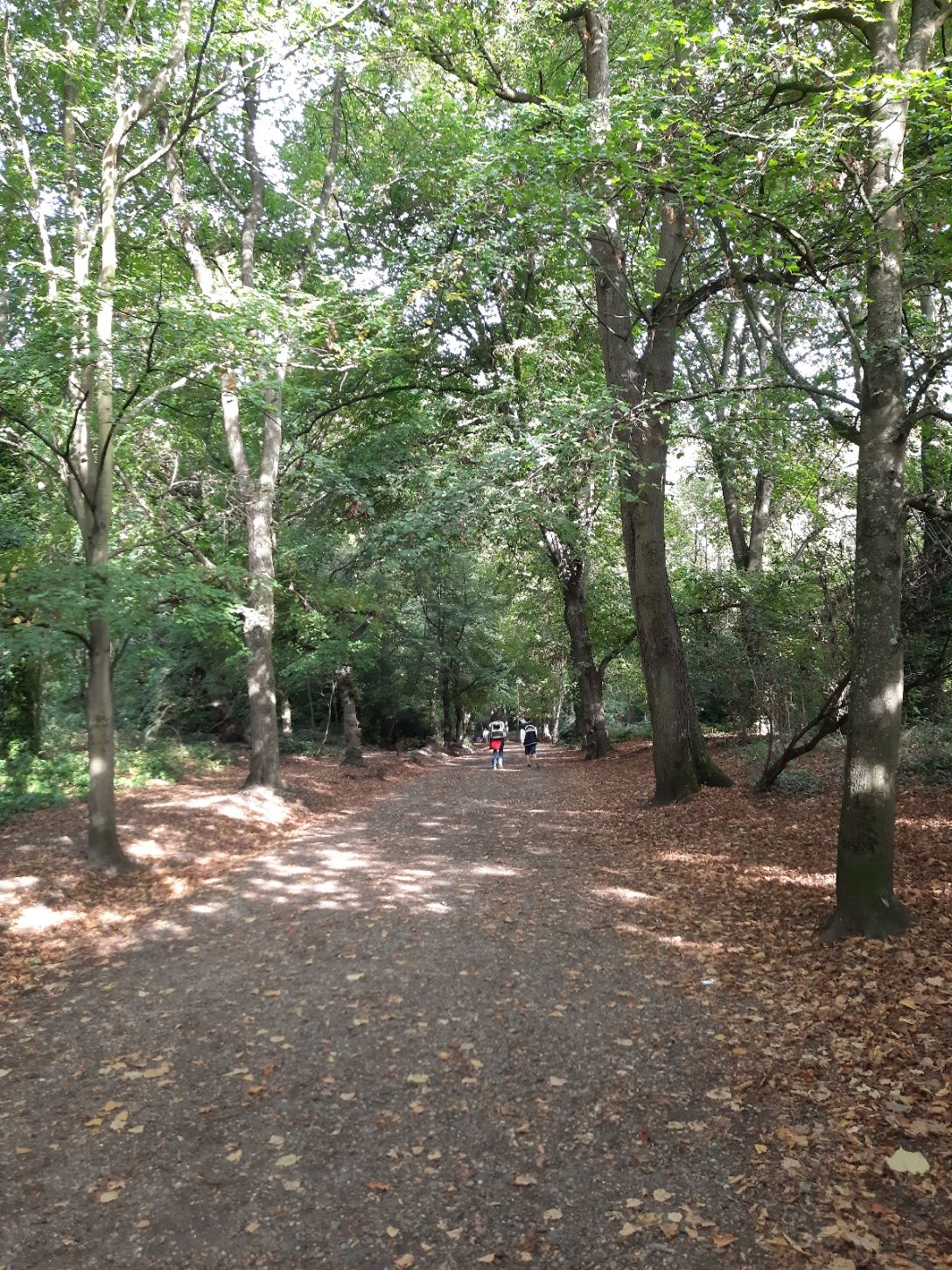 A path in the woods Description automatically generated
Introduction
An overwhelming body of evidence shows that biodiversity is in serious decline worldwide. According to the Natural History Museum, the UK is one of the most nature-depleted countries in the world. The 2019 State of Nature report estimates that since 1970, 41% of UK species have decreased in abundance and 15% of species are now threatened with extinction. In 2019, Parliament declared a Climate and Ecological Emergency, identifying an urgent need to reduce damage to our ecosystems and restore biodiversity. The Environment Act of 2021 recognises the connection between climate change and biodiversity, as well as air quality, water, and waste and aims to improve the natural environment as a means to limit climate change.
The Plan area, which includes a major part of Hampstead Heath, provides a wealth of habitats for wildlife and nature and is the source of four of London’s rivers: the Westbourne, Fleet, Tyburn and (part of the) Brent. Hampstead Heath supports a remarkable diversity of plants and wildlife, and plays a critical role in biodiversity in Central London and in surrounding residential areas. For instance, locally threatened London Priority Species that breed in residential Camden, like starlings, house sparrows and swifts, depend on meadows and ponds on the Heath for feeding. At the same time, bird species that breed on the Heath, including tits, thrushes, finches, warblers, woodpeckers and hawks, make use of our residential areas, including gardens, for winter feeding. Hedgehogs, another endangered London Priority Species, also move between the Heath, their central London stronghold, and gardens and allotments in surrounding neighbourhoods. Ecological networks connect the Heath to greater networks beyond the Plan area, such as the London Strategic Open Space Network, and provide a natural defence to climate change. The erosion of biodiversity in Hampstead includes loss of habitat including below-ground soil, gardens, trees, invertebrates and mycorrhizal fungi, birds, mammals and reptiles. Light pollution and deteriorating air quality are also damaging the natural environment.
Trees and open spaces, both privately and publicly owned, are immensely important to the character, welfare and resilience of urban areas. Hampstead, atop its sand, silt and clay-layered hill, is known for its leafiness and rural village feel that attracted and was the inspiration of many poets, writers and artists. The Heath fringes are an important aspect of Hampstead’s character: open, green and lush from the abundant springs and underground streams, and bringing the sight, feel and presence of nature into the village.
While Hampstead is both surrounded and dotted with woods and open spaces, its natural environment is under increasing threat from a variety of factors such as loss of gardens and trees through development.
Policy NE1: Supporting Biodiversity
The Environment Act of 2021 and the Cop 15 agreement of 2022 (Kunming-Montreal Global Biodiversity Framework), to which the UK was a signatory, set forth ambitious goals for increasing biodiversity by insuring that habitats are left in a measurably better state than they were before the development (Biodiversity Net Gain or BNG).
In England, BNG is mandatory under Schedule 7A of the Town and Country Planning Act 1990 (as inserted by Schedule 14 of the Environment Act 2021).
The Act applies to all development, including small gardens, with some exemptions. Biodiversity in Hampstead is supported not only by the Heath and identified corridors but traditionally by individual gardens and green spaces in almost all of this Plan’s character areas.
Paragraph 180 (d) of the NPPF states that planning policies should minimise impacts on and provide net gains for ‘biodiversity, including by establishing coherent ecological networks that are more resilient to current and future pressures.’
The Plan will support proposals for restoring front and back gardens, including reversal of previous paving over of gardens that accommodated parking spaces for vehicles. Biomass and necromass (dead and decaying material) in gardens can contribute to healthy habitat and a BNG.
A wide body of evidence suggests that blue-rich white outdoor lighting is detrimental to the ecosystem, to the enjoyment of the night sky, to astronomical research and possibly to human health. See Appendix 1, Evidence Base, for more information.
Policy NE2: Ecological Networks and Biodiversity Corridors
 OLD Map 5:
Open Spaces, Biodiversity Corridors and Veteran Trees Map — new map
coming
OLD Map 5:
Open Spaces, Biodiversity Corridors and Veteran Trees Map — new map
coming
N.B. Draft; still to have arrows placed showing links between green infrastructure for wildlife movement, all placed on new map and another showing wider area with veteran trees, adjacent networks and SINCs in neighbouring NF plan areas (Frognal Lane Gardens, Belsize Wood etc)
Local Green Spaces and Provisional LGSs
Biodiversity Corridors
Open Spaces with other designations including:
London Squares Preservation Act 1931 Designation and
Camden Local Plan — Public and Private Open Space
Sites of Importance for Nature Conservation
Hampstead Heath
Veteran trees
Network Priority Areas: opportunities for connecting surrounding
green infrastructure
Links between surrounding green infrastructure
See Appendix 2, Open Spaces and Biodiversity Corridors, for detailed maps and list of open spaces and biodiversity corridors.
NEW MAP 6 COMING SHOWING NETWORKS IN PLAN AREA
An ecological network refers to a system of interconnected habitats, landscapes, and biodiversity corridors (defined below) that are designed to support free movement of wildlife.
Hampstead Heath, along with other Sites of Importance for Nature Conservation, supports a remarkable diversity of plants and wildlife. But these islands of diversity cannot exist in isolation. To fulfil their potential for nature, they must connect through ecological networks. The Plan outlines priority areas between these green islands as opportunities to enhance connectivity and reduce fragmentation.
Every garden has a part to play in supporting biodiversity. The Plan area contains certain unique characteristics: an important number of veteran trees, wet areas and ponds and the large number of forest-type trees interspersed in large gardens.
Some features such as tree lines or boundary hedges however are shared by several gardens. Many wildlife species need to be able to travel to reach other areas of habitat for food or refuge or to balance their population. Ecological corridors and stepping stones are defined in the government white paper Biodiversity 2020: A strategy for England’s wildlife and ecosystem services, page 18, as areas “enabling species to move between core areas. These can be made up of a number of small sites acting as ‘stepping stones’ or a mosaic of habitats that allows species to move and supports ecosystem functions.” To ensure that such networks are maintained, protected and promoted, those submitting development proposals may be required to carry out ecological appraisals and species surveys. Camden Planning Guidance - Biodiversity provides guidance as to when these should be undertaken and what they should comprise.
Tree canopy lines, veteran trees, ancient hedgerows and our network of green spaces form an important habitat for birds, bats and other species.
Some of the biodiversity corridors are also historic tree lines. The Plan identifies six historic tree lines that appear on the 1866 Ordnance Survey Map (see Map 5 above and Appendix 4 for further information). These tree lines support tall trees of the type mentioned in 4.11, which will become the veteran trees of the future. Veteran trees are of particular ecological value, supporting a wide range fauna and fungi, many of which depend on long time periods of continuity in their habitat. Trees will be considered separately and specifically in Policy NE4: Trees.
Methods for improving connectivity in the network priority areas can include increasing tree canopy, soil continuity and habitat.
The continuity of tree canopies for invertebrates above ground and soil for fungi and mycorrhizas below ground in historic tree lines is paramount. Justification for removing trees might include that they are dead or dangerous, or an inappropriate ‘invader’ (e.g. laurel) causing distress or overcrowding to trees that are appropriate for an historic tree line in the Hampstead Plan area. Any pruning should attempt to preserve canopy continuity of the line and habitat. Trees within an historic tree line that require removal should be replaced by taller species that support a range of invertebrates, and new buildings/extensions set back to allow for future canopy growth.
Concrete slabs permanently degrade the garden surface, reduce trees’ rooting areas by removing opportunities for them to absorb oxygen, and damage the environment when removed, degrading the ability of gardens to support biodiversity. Permitted development does not apply in cases where the potential area of hard surface would be in excess of 5sqm, unless the householder uses porous materials or ensures that run-off is directed to a permeable surface within the grounds of the property.
Policy NE3: Local Green Spaces
The National Planning Policy Framework states that local communities, through local and neighbourhood plans, should be able to identify green areas for special protection, introducing a new Local Green Space (LGS) designation. These will be of particular importance to the community for their beauty, historical importance, and richness of wildlife or recreational value. Local policy for managing development within an LGS should be consistent with policy for Green Belts.
NEW MAP WITH JUST LGS
The sites in the Hampstead Neighbourhood Plan Area listed above, (see Map 5 and Appendix 3) are to be designated as Local Green Spaces as defined in the NPPF. Each of these sites complies with the criteria that it is in close proximity to the community it serves, is local in character and not extensive, and is demonstrably special to a local community and holds a special significance. A list of designated LGSs is given in Appendix 5 with evidence to support the designations. Additional information on each site is in our Evidence Base, Natural Environment, Local Green Spaces file.
The Plan recognises the value of existing green and open spaces on social housing and private estates and for residential blocks in the Hampstead Neighbourhood Forum Area and wishes to ensure adequate provision of open space for residents. The Plan acknowledges that benefits can be gained through estate regeneration schemes, but suggests these benefits be weighed against any loss of open space when planning applications are assessed.
As part of any planning application for development within or immediately adjacent to an LGS, developers should demonstrate how the LGS will be protected from the impact of the proposed development and its construction, and how the landscaping, amenity and biodiversity of the area will be preserved or enhanced (see also Policy NE2).
The Hampstead Conservation Area Appraisal and Management Strategy (Hampstead Conservation Area Statement 2002) sets forth policies concerning areas that fringe the Heath. The Plan supports Heath Fringe policy HF3 which “seeks to control development along roads leading to the Heath and in the gardens and trees adjacent to the Heath so as to safeguard their present contribution to the setting of the Heath.”
Overgrown greenery and mature landscapes are typical of the areas surroundings the buildings and suit the character for fringes of the Heath. Development on the fringes must seek to preserve their character.
Policy NE4: Trees
The UK has a goal of increasing tree cover from 14.5% to 17.5% by 2050. Included in this goal are groups of trees and individual trees.
Urban trees provide numerous environmental, health, social, biodiversity and economic benefits. Trees provide shade in summer and help mitigate climate change by absorbing CO2, reducing air pollution, promoting biodiversity and naturally cooling the build environment in the summer and warming it in the winter.
Trees have an important role to play in climate change mitigation. Tree canopies slow the movement of rain to the ground thus reducing surface run-off and sharp increases in groundwater flow during and following intense storms. This is especially important in Hampstead because of its hydrogeology and the risk of flooding from surface run-off, particularly for houses located towards the bottom of slopes.
The main tree species that define our area include the taller limes, London planes, oaks, willows, black and Lombardy poplars, beech, horse chestnut and Scots pine, most of which take several decades to reach maturity.
Importantly, the Hampstead and neighbouring Plan Areas are home to numerous veteran trees, shown as significant trees on the Ordnance Survey Map of 1866: Hampstead Heath has over 500; some oaks are more than 500 years old. Others can be found in front and rear gardens around the Heath despite 19th-21st century development. Ninety trees on the 1866 OS map of Hampstead have been found to still exist within the town (see Appendix 6 Veteran Trees). The origin of many of these can be traced back to historic hedges and boundaries. It is vital for maintaining and enhancing biodiversity that they continue to retain physical links to the veteran hedgerow trees on the Heath.
Other important trees were planted for aesthetic reasons, to line streets for example, or for practical purposes such as to soak up water in boggy gardens or to assist with stabilising slopes with a recent history of landslip.
The Important Tree List, Appendix 4, is a list of trees chosen by local people for their aesthetic and/or environmental or historic value. It is considered these trees make a significant contribution to public amenity for the purposes of The Town & Country Planning Act 1990.
The main tree species that define our area (as identified by paragraph 4.27 above) would be appropriate choices for replacement trees, though sufficient space for the mature trees, the neighbouring trees and other factors must be taken into consideration following the principle of “the right tree for the right place.”.
For most species, a “large” tree would be in the range of 15 metres tall or higher at maturity.
Development proposals where trees > 7.5cm in trunk diameter at 1.5m from ground and >1.5m in height are present (on-site or off-site) which have root protection areas or canopies that encroach onto the application site or could be affected by development, its plant or vehicles in any other way, are to be accompanied by a tree survey, arboricultural impact assessment, tree protection plan and an arboricultural method statement.
The Plan encourages the planting of trees that will produce a large canopy for shade, where appropriate.
Veteran trees
Tree protection guidance is provided in BS5837 (2012), the British Standard for trees in relation to design, demolition and construction but in Hampstead it is essential that all trees described as over-mature should be specifically assessed for veteran features. Presence on the 1866 Ordnance Survey map of Hampstead (https://maps.nls.uk/view/103312952) would indicate the tree to be of sufficient age and if the tree fulfils the criteria, it should be designated as a veteran.
The construction protection zones of veteran trees will be protected as determined for veteran trees by Natural England: ‘Standing Advice for Ancient Woodland and Veteran Trees’ and BS5837: 2012. A growing body of expert opinion suggests that the construction protection zone for such trees should be increased beyond the 15m radius recommended in the British Standard (See Shropshire Council guidance and David Lonsdale ‘Ancient and other veteran trees: further guidance on management’).
Where veteran trees are present on site or within 15 metres of the site boundary, development or demolition proposals will be required to be implemented in accordance with specialist guidance provided by an arboriculturalist with veteran tree expertise and VetCert trained [see https://www.vetcert.eu/certified-specialists] in order to ensure the protection and survival of the trees, unless it is demonstrated to the Council’s satisfaction that less than 15m is justified having regard to site conditions. Guidance could also be sought from veteran tree experts of the Corporation of London responsible for Hampstead Heath, who have agreed to provide such guidance.
Protection for veteran trees, particularly where compaction is a risk, must include a ground protection system that takes into account the weight of construction vehicles when under full load, up-dated by agreement with Camden Tree Officers if vehicles of greater loaded weights are ultimately required. The roots of veteran trees are particularly vulnerable to compaction. Ground protection should not be used to allow parking of vehicles over the RPA of a veteran tree. The location of how and where materials will be stored on-site should be included in the tree protection plan.
Landscaping proposals should have regard to the prevailing and historic pattern and extent of tree cover and landscaping and avoid hard standing within 15m of a veteran tree.
The Plan recommends that planning officers complete Natural England’s ‘Ancient Woodland and Veteran Trees: Assessment Guide’ when considering applications that may impact a veteran tree.
Site protection of trees during construction
All street trees near to the application site should be protected from damage in line with BS5837:2012 from potential movements by heavy vehicles, taking into account their maximum load.
In order to preserve tree canopy, the piling rig offering the lowest clearance possible should be utilised when working under the canopies of trees to minimise both potential damage and the need for access facilitation pruning.
 Basements
Introduction
These policies apply to all new basement development. Basement development is defined as the construction or extension of one or more storeys of accommodation below the prevailing ground level of a site or property.
Surveys among residents have resolutely identified this as being of considerable concern within the community and the evidence we gathered justifies these concerns. This policy seeks to ensure that full consideration is given to the potential impacts of basement developments at application stage.
Basement extensions can provide an opportunity to add space to homes in parts of the borough. However, Hampstead has a unique set of conditions that mean basement construction can inflict structural damage and/or trigger flood risks on susceptible neighbouring properties. These unique circumstances are summarised below.
Geography, topography, geology and hydrology
Hampstead is set on one of the largest and highest hills in London, with the highest rainfall of the Greater London area, and much of it located on the flank of that large hill. As a consequence, a significant number of Hampstead streets are downward sloping, where hard standing or building footprint enlargement produces additional surface run-off and drainage requirements, increasing flood risk in storm periods to vulnerable lower areas such as South End Green/Fleet Road, South Hampstead and West Hampstead.
 A flooded street with buildings and shops Description automatically generated
 A flooded street with cars and umbrellas Description automatically generated
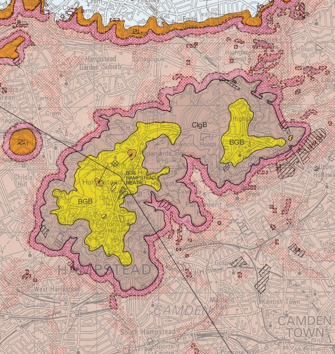
Hampstead is a complex layering of Bagshot Sand, Claygate Member and band D of the London Clay Formation. The top two layers have a high silt and sand component rendering them susceptible to high water conductivity and silt erosion, as well as being potentially less stable.
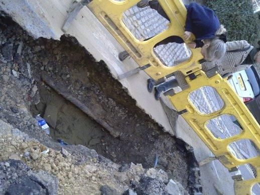 C:\Users\Janine\Dropbox\HNF Plan\Evidence Base to accompany Plan\Basement evidence\Sink Holes\2009 New End large hole appeared under roadway.jpg
 C:\Users\Janine\Dropbox\HNF Plan\Evidence Base to accompany Plan\Basement evidence\Sink Holes\Large hole under Heath Street from ground water erosion outside the Baptist church 1.jpg
On the left is a photo of a large cavity uncovered under Heath Street, outside the Baptist Church. To the right is a sink hole that appeared in New End. These illustrate the erosion of a significant volume of silt from the Claygate Beds by the action of groundwater, causing subsidence, cavities and sink holes. This action is magnified when basement developments constrain and thus speedup the groundwater flow.
Much of the area has been identified as an area of significant landslide potential, with variable susceptibility from the pressure changes of cutting into the hillside. Constraint and diversion of ground water and the local underground streams by basement construction can contribute to the lubrication of landslip on even gentle slopes. Adequate testing is particularly vital in Hampstead to inform the Basement Impact Assessment (BIA) and reduce the risk of unexpected and serious damage to development projects and to the neighbouring properties.
Other factors
A substantial part of the Neighbourhood Plan area constitutes rows of terraced Victorian or earlier townhouses with shallow foundations, “one of the riskiest situations in which to construct a basement,” according to Arup in the Eatherley decision, “because the property shares its existing foundations with its neighbours and also because it provides lateral support to its neighbours, any movement of the existing house resulting from the works will directly impact on its neighbours.” There are also a significant number of narrow streets in some areas.
Further, the construction of basements can give rise to noise and disturbance during construction, and the management of traffic, plant and equipment. The policies set out below seek to address these concerns and provide a clear policy framework for proposals for basement development within the Neighbourhood Plan area.
Basement construction, when it involves the severing of roots, can be damaging to trees, especially veteran trees. Basements can also reduce the capacity of historic tree lines to support the growth of future veteran trees by altering the ground water flow and diverting water towards or away from root systems.
 A map of a city Description automatically generated
  A brown surface with a white spot Description automatically generated with medium confidence
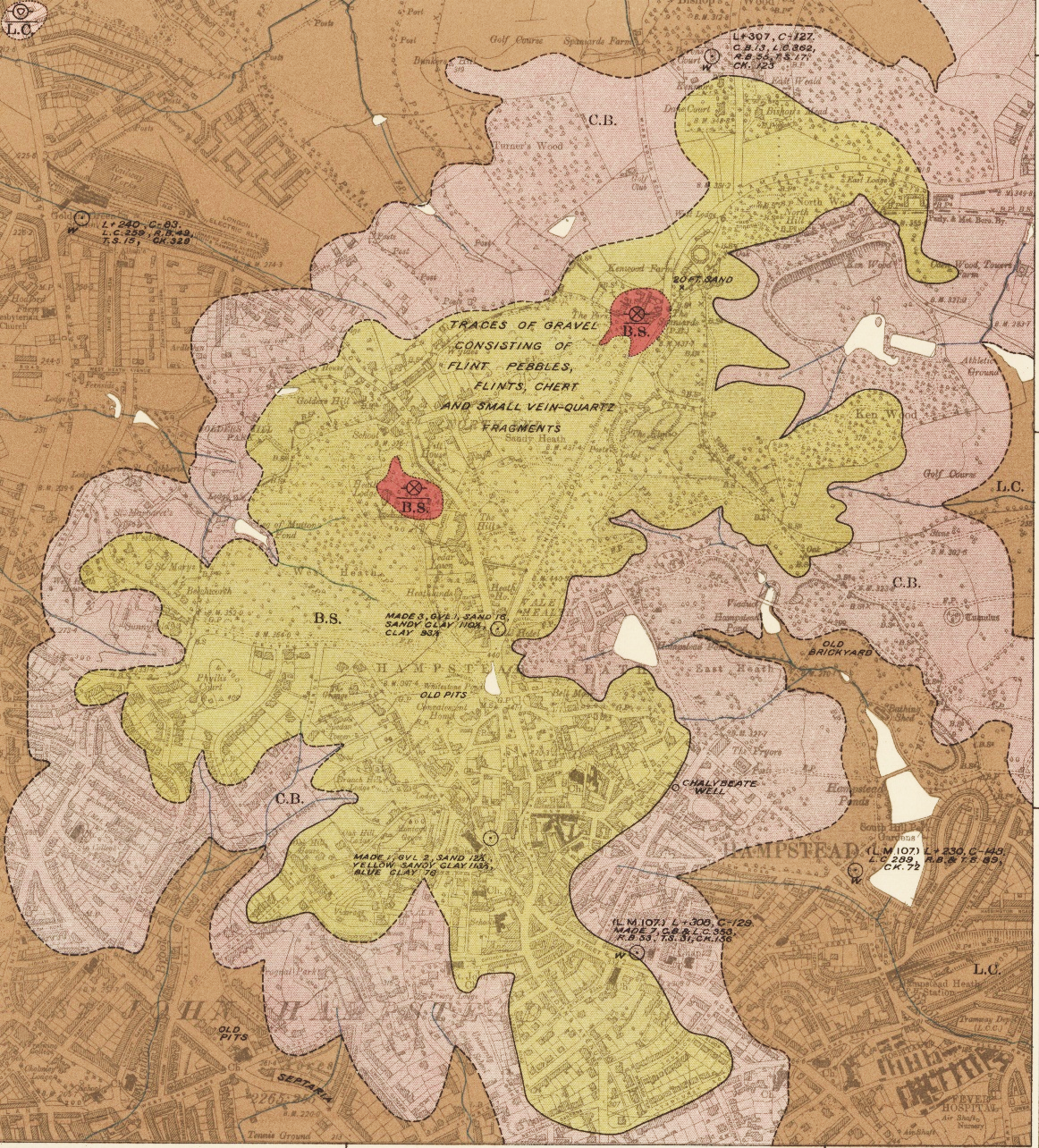
Hampstead is made of a hill of complex layering of Bagshot Sand (very permeable and erodible) at the top, Claygate Member (relatively & variably permeable) beneath the bagshot and then the layer of Band D of the London Clay Formation. Band D of the LCF is an upper more silty/sandy clay band that has more permeable and erodible partings within it. These are where past rivers & streams flowed through, and groundwater still can, particularly during and following storms, eroding fines (silts and anything ‘fine’ - very small particles that can get eroded from coarser materials/ground) as it goes into where a void has been formed.
 A map of land with different colored areas Description automatically generated
 C:\Users\Vicki\Pictures\Screenshots\Head propensity.png
The triad of superficial deposits/slope/groundwater make ground pressure changes from digging potentially very dangerous for landslide.
Policy BA1: Basement Development
As a result of the conditions found in Hampstead, basements in Hampstead may pose a particular risk to neighbouring properties and require close investigations, as required by Policy A5 of the Local Borough of Camden Local Plan and its supporting Camden Planning Guidance - Basements, to ensure that risks can be identified and damage mitigated at the planning stage. These conditions include unusual and unstable soils, subsoil water movement, hilly areas liable to slippage, and dense development in which many houses are conjoined.
Applications for basements where the involvement of an engineer and/or geotechnical professional and/or geologist has been commissioned or is expected to be commissioned by the applicant, the neighbour(s) or Camden, must involve suitably qualified professional experts as defined in Camden Planning Guidance (CPG) — Basements.
When a basement Impact assessment shows that additional steps need to be taken, those proposing basement development are encouraged to consider the following, where appropriate:
CPG — Basements and the Camden Geological, Hydrogeological and Hydrological Study (paragraphs 285-294) should be studied whenever hydrological borehole measurements are to be carried out. Soil samples, including those near boundaries with neighbours must be taken to a depth below the footing of the proposed base of the basement. The boreholes measurements may need to be conducted in periods of contrasting rainfall and over a period of several months covering wet and dry seasons.
In some cases, when boreholes measurements show a groundwater risk, an automatic log water measurements recorder may need to be left activated in the boreholes over a sustained period of contrasting rain cycles to demonstrate local groundwater and water table levels and the local extent of groundwater surges during and immediately following storms. In such instances, the amount of rainwater immediately preceding the borehole measurements on that day and in the prior days should be clearly documented in a report for all to see.
An assessment should demonstrate that the predicted Burland Scale at the time of the construction phase is no more than Burland Scale 1 throughout the building and each neighbouring building that has any part within the zone of influence (a distance of twice the depth of the basement from the point of the excavation). The assessment must show the location of the predicted impact and also demonstrate that the data entered, methodology and supporting engineering calculations are all submitted and stand up to scrutiny see also 5.19).
An assessment of current ground and geology conditions, topography and groundwater levels. The BIA should identify the structure and foundations of the existing building and of neighbouring properties where possible. Where there is uncertainty about the presence of subterranean development or insufficient data about building foundations, the applicant must make conservative assumptions when considering matters such as structural stability and groundwater flows.
If flooding and ground reports of both the applicant’s and the neighbouring properties are required, both the Landmark Information Group and the Conveyancing Data Services can provide such reports.
The location and distance of the property from areas identified as at risk of flooding as shown in the Strategic Flood Risk Assessment prepared for Camden by URS in July 2014.
Clarity over geology and groundwater conditions can sometimes best be explained through comprehensive cross sections, reports and graphs.
Hydrological modelling to show whether it will be possible through the inclusion of drainage systems to prevent any significant harm from changes to groundwater levels or flow, without resorting to diverting water to the sewer system. Hydrological modelling only needs to be done if it cannot be demonstrated through screening and scoping that there is no risk.
In order to protect from flooding if the sewer becomes full, Thames Water recommends the installation of a positive pumping device. This should be installed in each new basement development unless a strong case for alternative measures can be made.
A basement search radius of 50m around a development (100m in the case of large, detached villas) is recommended for the Plan area as advised in Camden’s Strategic Flood Risk Assessment (2014).
The team preparing the BIA should always visit the site of a proposed excavation.
To gain planning permission, developers need to demonstrate with appropriate evidence that the proposal would comply with Policy A5 of the Local Plan. Camden Planning Guidance — Basements provides detailed guidance on requirements for Basement Construction Plans. The implementation of Basement Construction Plans will be secured by planning obligations (Local Plan paragraph 6.127).
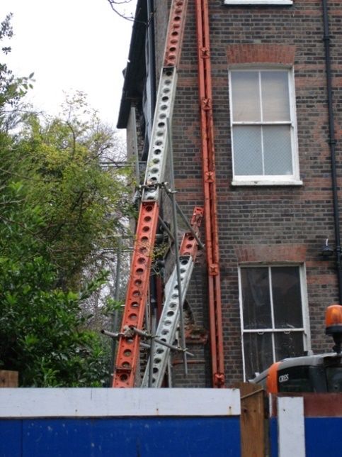
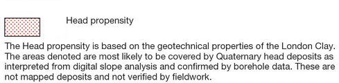
 Emergency
structural support in South Hill Park (left) and in Christchurch Hill
(right) caused by basement developments
Emergency
structural support in South Hill Park (left) and in Christchurch Hill
(right) caused by basement developments
The Basement Construction Plan should be prepared to a Detailed Proposals Stage (equivalent to RIBA stage 4, RIBA Plan of Work 2020). Development proposals close to London Underground tunnels or other infrastructure which might interact or conflict with them must be referred to Transport for London, with details of all construction proposals and methodology.
Applicants are encouraged to submit a consultation statement providing evidence of consultation with neighbours prior to the application, any comments received, and any changes made to the application in light of those comments.
The Basement Construction Plan will be produced by a suitably qualified engineer and include the relationship between permanent and temporary works and how vertical and lateral loads are to be supported.
Policy BA2: Construction Management Plans
In the dense residential streets of Hampstead, many of which are very narrow, construction of basements has a considerable impact and is a major cause of public concern in relation to pollution, noise and danger. In the Camden Basement Evidence Report of February 2016, more than half of the respondents said that they thought the impacts on noise, vibration, and dust were unacceptable, with just under half of the respondents also stating they thought the impacts on traffic and parking were unacceptable.
The impact of construction is further exacerbated when there is more than one basement development in close proximity or in the same street. The main construction impacts relate to construction traffic, parking suspensions, noise, vibration and dust.
Applicants should address all the processes involved in the construction of their basement and describe mitigation measures to be used to keep noise, vibration and dust to acceptable levels under the relevant Acts and guidance (including the Control of Pollution Act (COPA) 1974, the Environmental Protection Act 1990, the Noise Emission in the Environment by Equipment for use Outdoors Regulations 2001, and BS5228-1 2: 2009: Code of practice for noise and vibration control on construction and open site). The more complex the proposed basements, the more detailed the levels of information which should be provided at the application stage.
Sharing emerging proposals related to traffic and construction with residents and businesses in the vicinity is beneficial as their local knowledge and needs can be more readily taken into account.
The Construction Management Plan (CMP) should include limits on hours of construction as per paragraph BA2 (4) above.
 Traffic and Transport
Introduction
Sustainable, clean transport is important in mitigating climate change and improving air quality.
Traffic congestion and associated vehicle emissions are key concerns in the Plan Area, with levels of Nitrogen Dioxide (NO2) pollution in many of our residential roads reaching levels which are substantially above national & EU objectives. In view of the risk to the public, the London Borough of Camden has been designated an Air Quality Management Area (AQMA). To tackle the problem of air quality, the borough has established an Air Quality Partnership and developed an Air Quality Action Plan (AQAP).
The AQAP 2023-2026 encapsulates the Mayor’s Transport Strategy and Camden’s Transport Strategy 2019-2041, whose first objective is to improve air quality and reduce transport’s impact on climate change. In Camden, road traffic is responsible for about half of all NO2 pollution.
The strength of local feeling on matters of congestion and pollution is reflected in the fact that these issues received the third largest number of written comments during community consultation.
To tackle these issues, London Plan Policy T1 sets an ambitious aim that 80% of all trips in London will be by foot, cycle or public transport by 2041. Policy T1 of the Camden Local Plan encourages developments to prioritise sustainable travel modes. While the community’s ability to control traffic congestion and vehicle emissions through the planning process is limited, the National Planning Policy Framework (paragraph 192) requires planning policies to contribute towards compliance with national objectives for pollutants, taking into account the cumulative impact of development, and to seek opportunities to improve air quality through traffic and travel management.
The Neighbourhood Plan therefore provides development policies to guide the implementation of these objectives in the specific context of the Plan area followed by guidance on relevant strategies that lie outside the remit of planning policy, but which are nevertheless important to the local community and to the sustainability of the neighbourhood.
In line with the National Planning Policy Framework (NPPF paragraphs 28 and 29), the Neighbourhood Plan is designed to provide clear policies that support or supplement the strategic elements of the Local Plan. In addition to supporting individual developments, neighbourhood policies also need to take into account the cumulative impact of multiple developments on the local area, meaning that area-wide policies dealing with the transport impacts of development are required. The Forum considers that clear definitions and policies can play an important role in supporting development by giving both developers and the community the confidence to make appropriate decisions. To this end the Plan’s transport policies incorporate the following simple definitions to guide development, and which are described more fully in this section:
Heavy goods vehicles which carry a high risk of causing disruption to traffic movement or damage to pavements in the Plan Area are defined as vehicles over 7.5 tonnes of unladen weight in line with Camden’s Planning Guidance, Transport, 2021, paragraph 4.23.
Sites for large developments, schools and education institutions in the Plan Area should be selected with full regard for their accessibility and connectivity. Sites with a public transport accessibility level (PTAL) score over 5 should be considered favourably, as could those which demonstrate good accessibility for pedestrians and cyclists.
In the context of the Plan area, developments involving a reasonable expectation of an additional 100 or more person trips per day (equivalent to the total number of trips generated by two single-practitioner dental surgeries) are defined as requiring special care to ensure that their transport impact is assessed and appropriately managed.
Traffic and pollution
Hampstead village is dominated by the A502 London Distributor Road, which runs through its centre and along a narrow and frequently congested section towards Whitestone Pond. The B511 and B519 Borough Distributor roads running along Fitzjohn’s Avenue and Spaniards Road suffer frequent congestion. Roads leading to South End Green are heavily used and Fleet Road suffers from stationary or slow-moving traffic during most daytime hours. The community has expressed particular concern about the wide catchment areas of some local schools, resulting in high volumes of traffic coming from outside the Plan Area, causing chronic congestion at peak times.
Community responses indicate a high level of support for measures to reduce traffic congestion and encourage the use of sustainable transport.
The Hampstead Neighbourhood Forum has conducted two studies of air pollution in the Plan area. The 2015 study revealed high levels of air pollution. Only in a few areas, such as the middle of Hampstead Heath, did the level of nitrogen dioxide (NO2) fall well below limits set by the EU. The highest level of NO2, more than twice the EU limit, was recorded at the junction of Arkwright Road/Fitzjohn’s Avenue and at Spaniards Inn.
The second study, carried out over a 12-month period in 2021/22, revealed that NO2 levels were still close to or above the UK legal limit in a number of locations, namely the main traffic arteries of South End Green, Pond Street, Heath Street and Rosslyn Hill. They also exceeded the World Health Organisation limit in all surveyed locations, even on Hampstead Heath. The measurements were of average pollution levels, and therefore the NO2 levels during rush hour/school run times were likely to be much higher.
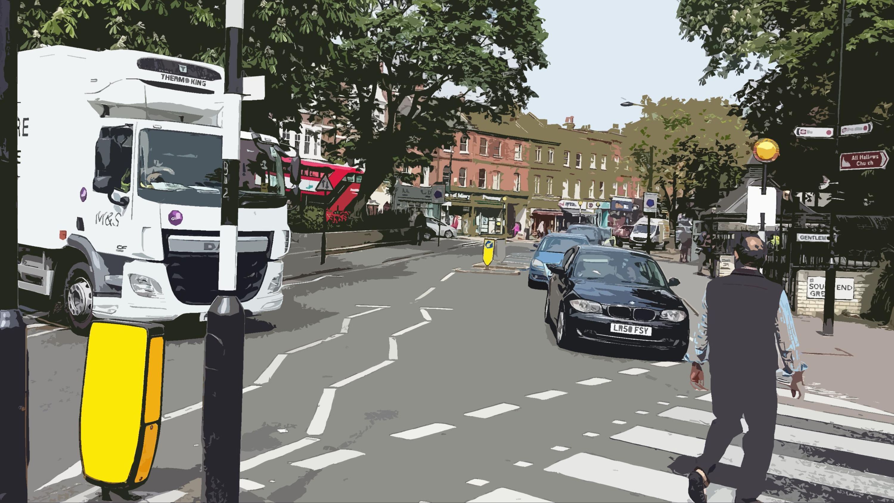
Responses during community engagement indicate particular concern over the harm done by large construction and delivery vehicles. In addition to noise, these vehicles cause physical damage to the surfaces of roads and pavements, and clog up narrow streets, impeding the free movement of traffic and frustrating pedestrians and other road users. The Forum considers a development size of 300m2 gross internal area to be a reasonable threshold, above which special care is required to manage service and construction vehicles so as to avoid undue impact on the Plan Area. Having reviewed the various vehicle categories, the Forum has concluded that a vehicle size of 7.5 tonnes unladen weight is the maximum which is desirable, given the Area’s complex street pattern and many width restrictions.
 Congestion caused by large vehicles - Holly Bush Vale - Hampstead
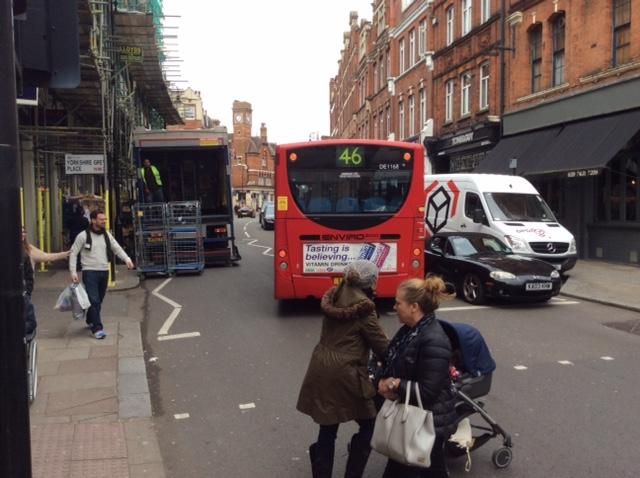 Large Tesco Delivery Vehicle - High Street Hampstead
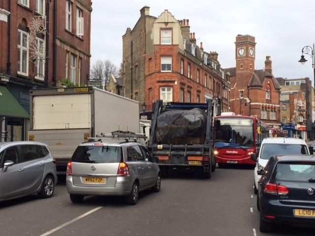 Tesco Delivery Lorry - Traffice Congestion - Heath Street Hampstead
The Plan recognises that the area immediately surrounding a development site is not the sole consideration in assessing transport impact because additional vehicle traffic will necessarily have to move across other streets in the Plan Area (the vast majority of which are narrow and residential) in addition to the street on which development is taking place. The Plan also needs to take account of the cumulative impacts on the local area of the use of very large construction and delivery vehicles and in these circumstances, the Forum has concluded that an area-wide policy is appropriate.
Where vehicles are used for servicing and delivery it is important that their impact is considered at an early stage. The following areas are responsible for most impact, but are not included in the required content for the Council’s Transport Assessment set out in Camden Planning Guidance on Transport, 2021, meaning that submission of this information separately or through a Delivery and Servicing Plan may be necessary to ensure that servicing and delivery requirements are given due consideration:
Scheduling of deliveries and service visits.
Proposed location for vehicles during loading/unloading.
Size and height of vehicles.
Planned waiting times.
Loading and unloading requirements, including numbers of operators and the need for additional kerbside space for pallets and machinery.
As road capacity cannot be increased within the Plan Area and as traffic congestion and vehicle emissions are already well above acceptable levels, the transport sustainability objectives set out in the National Planning Policy Framework (NPPF) and the AQAP can only be achieved by a net year-on-year decrease in the use of motor vehicles. Policy T2 of Camden’s Local Plan proposes that all new development in the Borough will be car-free.
All applicants are therefore encouraged to consider creative solutions that will avoid increases in motor vehicle traffic and thereby promote economic, social and environmental sustainability.
Inevitably, some developments which offer overriding benefits on other grounds may have the effect of increasing motor traffic at a specific location. Given the critical importance of reducing pollution and congestion levels (and in line with the National Planning Policy Framework (NPPF paragraph 32)) where adverse impacts are unavoidable, and all reasonable mitigation has been provided, it may be necessary to offset any increase through other measures so that a development does not lead to an overall increase in traffic volumes within the Plan Area.
To this end, where an increase in vehicle traffic is unavoidable and cannot otherwise be mitigated, then public realm or public transport improvements to achieve corresponding reductions in vehicle usage elsewhere in the Plan Area should be delivered through the use of planning obligations, so that development does not lead to a net increase in motor vehicle usage.
In line with Camden’s Planning Guidance — Transport 2021, the Forum has concluded that the measure of ‘person trips’ should be used as the starting point to assess transport impact.


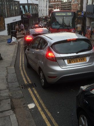


Policy TT1: Traffic volumes and vehicle size
Comprehensive guidance on Transport Assessments, Transport Statements and Delivery and Servicing Management Plans can be found in Camden Planning Guidance — Transport 2021 and via TfL’s website. Guidance on Air Quality Assessments can be found in Camden’s Local Plan. Developments expected to generate an additional 100 or more person trips a day (as referenced in paragraph 6.6c) are regarded as “significant” for the application of Policy TT1. Exceptionally, some developments which generate smaller numbers of additional trips may also be expected to provide assessments, because of site-specific circumstances.
It should be noted that Transport Assessments, Transport Statements and Delivery & Servicing Management Plans (DSMPs), while being essential planning tools, should not be burdensome and need only be proportionate to the scale of development. They are a tool to ensure that potential transport impacts of a planning application are given appropriate consideration. In line with the National Planning Policy Framework (NPPF 44) they need only contain information which is relevant, necessary and material to the application in question. Applicants should discuss, and agree, the need for and content or scope of these documents with the local planning authority at the pre-application stage. This helps to avoid abortive work by applicants and planning officers, and the need for later revisions to the documents or development proposals.
Where a DSMP is required, the Plan strongly encourages the submission of a full DSMP during pre-planning to ensure that the practical impact of development is considered as early as possible. Where an outline DSMP is provided it should contain sufficient information to confirm that the material impacts of servicing and delivery on the transport system and on amenity have been appropriately considered and mitigated.
The depth of analysis required should reflect the scale of a development and the extent of its impact on local transport capacity and local amenity.
As with other planning matters, where a planning application is granted, the provisions of any associated DSMP will apply to future beneficial owners of the land or property described. The DSMP should reflect all reasonable expectations of the delivery and servicing requirements associated with the proposed land use at the time of the application and where a future owner wishes to go beyond the provisions set out in the relevant DSMP, a new planning consent will be necessary.
It should be noted that paragraph 1 of Policy TT1 is concerned with additional motor vehicle use and its objective is to prevent additional vehicle traffic and pollution. Therefore, if existing premises are refurbished or redeveloped in a way which does not increase motor vehicle use or pollution then paragraph 1 of this Policy will not apply. However, applicants should also have regard for the London Plan’s Policy T6 (L): Parking. This states that the existing parking provision for refurbishments should be reduced and not re-provided at the same levels where this would exceed the standards for new development set out in that policy.
Further guidance on Construction Management Plans can be found in Camden Planning Guidance — Amenity. To ensure that the practical impact of development is considered as early as possible the Plan strongly encourages the submission of a full CMP during pre-planning. Where an outline CMP is provided it should contain sufficient information to confirm that the material impacts of construction on the transport system and on amenity have been appropriately considered and mitigated. In line with the National Planning Policy Framework (NPPF 44), CMPs should not be burdensome, should be proportionate to the scale of development and need only contain information, which is relevant, necessary and material to the application in question.
Where a Transport Assessment, Transport Statement, DSMP or CMP is required, and in line with NPPF paragraph 40, the Council will take into account evidence provided to it that the applicant has consulted the local community affected by the development and has taken their reasonable concerns regarding any potential harm to the area into account
The Plan encourages Camden Council to work with TfL and other organisations to discourage through traffic entering the Plan Area, particularly by promoting the following measures:
Downgrading the A502 London Distributor Road given its unsuitability for heavy vehicles north of Hampstead village.
Use of signposting at key entry points to discourage traffic from entering the Plan Area where more appropriate choices, such as the A41 Finchley Road are available.
Policy TT2: Pedestrian environments
Hampstead Village and South End Green offer village and neighbourhood environments that attract large and growing numbers of visitors, children attending the many local schools and their parents. The commercial, social and environmental health of these centres is heavily dependent on footfall and the maintenance of a pleasant and welcoming experience for pedestrians. Visitors do not follow linear paths and frequently wish to browse and move from one side of the road to the other.
The sustainability of Hampstead and South End Green centres depend on measures that maintain high levels of permeability, improve driver behaviour and avoid concentrations of pedestrians at specific crossing points, so that pedestrians and shoppers feel able to cross the streets freely and safely.
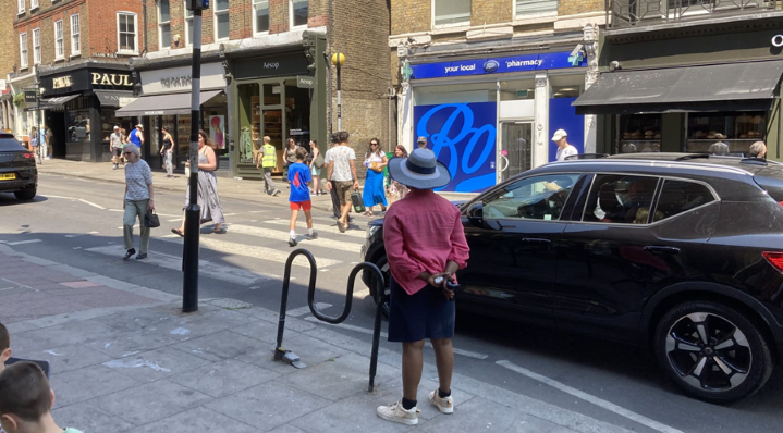 Our
High Street Survey in 2023 showed that the number of pedestrians using
the Oriel Place zebra crossing on weekday afternoons and weekends
consistently exceeded all other road users combined.
Our
High Street Survey in 2023 showed that the number of pedestrians using
the Oriel Place zebra crossing on weekday afternoons and weekends
consistently exceeded all other road users combined.
Yet, substantial traffic volumes not only affect air quality, but result in vehicle dominance, making Hampstead’s streets less pleasant and frustrating the Mayor’s objective to encourage more sustainable forms of travel. Our 2023 survey showed that far from diminishing, traffic through Hampstead High Street during peak hours increased by up to 7% compared with 2019.
To make streets more welcoming for pedestrians, Policies T2 and D8 of the London Plan require development to reduce the dominance of vehicles, to increase the permeability of streets, remove unnecessary street clutter and avoid barriers to movement that create severance for pedestrians and cyclists so that pedestrians can cross the street more easily. The Camden Transport Strategy 2019-2041 establishes a hierarchy of road users, giving priority to pedestrians ahead of all other modes of travel, while Policy T1 of the Camden Local Plan seeks to ensure that developments improve the pedestrian environment.
The Plan Area benefits from a network of traditional zebra crossings, which comprise the majority of crossing points and which make an important contribution to the character of the Plan Area. In addition to being less visually intrusive than other crossing types, they work together, alongside Camden’s 20mph speed limit, to modify driver behaviour in the neighbourhood, requiring greater awareness of pedestrians and pavement activity.
This zebra crossing network has proved effective in reducing vehicle dominance and promoting pedestrian permeability. It is resilient to increases in pedestrian volumes, minimising delays road users taken as a whole. Our 2019 and 2023 High Street surveys showed that the Oriel Place zebra crossing proved highly responsive, supporting up to 1,385 pedestrians per hour without affecting vehicle flows.
Where possible, development should promote the existing pedestrian crossing network and should seek to create a more welcoming environment for pedestrians and cyclists, while promoting the area’s vibrancy and historic character.
Department for Transport statistics published in 2015 showed that serious injuries and deaths to pedestrians at zebra crossings in the UK are half those of “controlled” (pelican/puffin) crossing types, despite the fact that the numbers of zebra and controlled crossings are similar. TfL’s report “Collision Levels in Greater London 2011-2013” showed that the numbers of zebra and controlled crossings in Greater London are equivalent. This safety benefit appears to result from two factors:
Greater use of zebra crossings in areas where speed limits are 20mph or less.
The tendency for drivers at controlled crossings to look only at the traffic light (so that they are often unaware of pedestrians and cyclists) compared with the need to be more aware of pavement activity when approaching a zebra crossing.
Where it is necessary to introduce traffic calming, deployment of additional crossing points and enforcement of the 20mph speed limit should be considered as a first-line measure in preference to the use of barriers, signs, furniture and segregation.
In view of their safety and aesthetic benefits and given the enforcement of a 20mph zone throughout Camden, the use of zebra crossings is encouraged as the first-line option for pedestrian crossings within the Plan Area.
“Shared Use Road Schemes” (generally a kerb-free single surface, with pedestrian areas distinguished by visual and tactile lines) involve a high cost, but community engagement indicates such a scheme would be welcomed for South End Green provided implementation did not detract from the character of the area.
Measures to promote a similar awareness of shared space through additional crossing points and a reduction in street furniture are strongly supported, so that motorists are encouraged to be more vigilant. Responses received during community engagement indicated a desire to increase the number of pedestrian crossing points on various roads, including Fitzjohn’s Avenue.
Policy TT3: Public transport
A widely recognised way to measure connectivity to the public transport network in London is the PTAL (Public Transport Accessibility Level) system, adopted by Transport for London as the standard method to calculate access to public transport. The PTAL value combines information about how close public transport is to a location and how frequent the service is. The highest level of connectivity has a PTAL of 6b (excellent) and the lowest has a PTAL of 0 (very poor).
Transport for London’s 2014 analysis (the latest published) shows that the Hampstead Town ward has a relatively low PTAL score at 4.0, which is noticeably below the borough-wide score of 5.6 for Camden. The percentage of people in Hampstead Town ward living in areas with a PTAL score of 3 or less is 70% of the total population, compared to only 29% across the borough as a whole.
The TfL map reproduced here shows that connectivity in the most populated part of the Plan Area is closely associated with bus provision. South End Green, at the extreme south of the HNF area is served by four regular bus routes, two of which pass through popular areas of the West End and central London on their way to their final destinations to the South or South-west of the city centre. However, both routes terminate at South End Green. The remaining 90% of the Plan Area (including Hampstead Town) is served by only two regular routes, one of which is a local service only, offering limited connectivity with journeys of less than 2km from Hampstead.
Sites located in areas of better connectivity permit residential development at higher densities together with the use of buildings for public or educational purposes. They also permit car-free development. Areas without good connectivity are not suited to these purposes unless development is made sustainable through corresponding improvements in public transport.
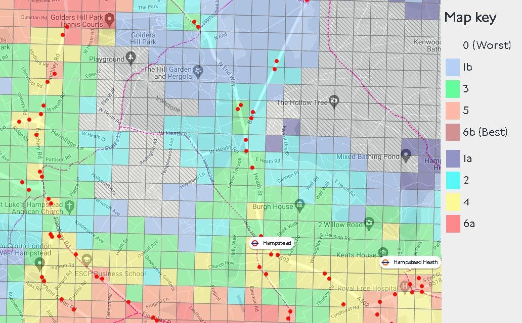 C:\Users\CW\AppData\Local\Packages\Microsoft.Windows.Photos_8wekyb3d8bbwe\TempState\ShareServiceTempFolder\PTAL in Plan Area - 2024-03-22.jpeg
PTAL scores
Source : Transport for London WebCAT Connectivity Assessment Toolkit , 2024
(https://tfl.gov.uk/info-for/urban-planning-and-construction/planning-with-webcat/webcat
The Forum considers TfL’s PTAL calculation to be a cost-effective means of assessing public transport accessibility in connection with development proposals in view of its maturity, the simplicity of its calculation and the wide availability of calculation tools. A PTAL value can be quickly established for an individual address and TfL’s PTAL Assessment Guide enables the benefits of proposed changes in public transport (for example the relocation of a bus stop) to be quantified in a simple and objective way.
Hampstead’s chronic traffic problems mean that even relatively small increases in demand, particularly those associated with the many popular schools which lie within the Plan Area, can have a disproportionate impact and responses during community engagement indicated particular concern over schools that attract pupils from other parts of London, resulting in additional journeys into the Plan Area from outside.
Given the critical importance attached to reducing traffic congestion and improving air quality, the Forum has concluded that new health and educational facilities should be located in areas with a good PTAL score for existing or planned public transport connectivity. It is these facilities that involve heightened safeguarding needs and where a significant number of additional journeys are likely to be generated). The Forum recognised that some transitional arrangements were needed and the Hampstead Neighbourhood Plan 2018-2033 Plan set a minimum PTAL score of 4 for its first 5 years to 2023 and 5 for the remainder of the Plan’s lifespan. The responsibility will lie with developers to justify any exception to this approach: for example; by demonstrating that the travel patterns would not lead to increases in traffic at peak times, or that a Travel Plan could mitigate harmful effects of congestion and air pollution.
In line with Camden’s Planning Guidance — Transport 2021, the Forum has concluded that the measure of ‘person trips’ should be used as the starting point to assess transport impact and for this purpose an expectation of 100 new person trips per day represents a significant threshold, given the specific context of the Plan Area, above which special care is required to ensure that public transport facilities are adequate.
An example of a public transport improvement meeting the requirements of this policy is the development of a new health centre which is accompanied by improvements in bus frequency and the re-siting of bus stops to elevate the PTAL value of the health centre’s site.
Policy TT4: Cycle and car ownership
While Policy T2 (Parking and Car-free Development) of the Camden Local Plan requires that all new developments are car free. In the draft Camden Local Plan 2024, Policy T2 would require development to “provide for high quality, accessible, inclusive, convenient, and safe cycle parking facilities, exceeding the minimum standards outlined in the London Plan”.
The Plan’s objectives to reduce motor traffic and improve pedestrian environments are designed to promote an increase in cycling. TfL’s Attitudes to Cycling 2014 report shows that 59% and 24% of respondents regarded safety concerns and traffic volumes respectively as the reasons why they had not taken up cycling. By contrast, age and poor cycling facilities (including lanes and street parking) were listed by only 10% of respondents.
As cycle use grows in the longer-term, and given the lack of a cycle hire scheme, it will become increasingly important that buildings offer safe, covered & convenient residential cycle storage sufficient to support all the occupants of a dwelling. This is especially important in the case of apartments, where the unsightly storage of bicycles on apartment balconies is a clear indication that residential cycle storage facilities are inadequate.
Provisions for covered street cycle storage in many parts of the Plan Area are limited or would conflict with the area’s historic character. Therefore, to ensure that development in the Plan Area is sustainable, particularly for families, in the longer-term a specific effort is needed to ensure that new homes are as cycle-friendly as possible.
The northern extension of TfL’s cycle hire area beyond Camden Lock is strongly supported.
Car ownership in the Plan Area is much higher than in the rest of Camden. In 2021, 54% of households in Hampstead Town ward had access to one or more vehicles, compared with 35% elsewhere in the borough. Moreover the rate of decline is decreasing, with the ratio of households having access to vehicles in Hampstead Town dropping from 60% to 55% between 2001 and 2011, but only from 55% to 54% between 2011 and 2021.
Of those wards achieving higher reductions, the improved availability of public transport appears to have been a factor. In Camden all 12 wards achieving reductions of 12% or more between 2001 and 2011 benefited from PTAL scores of between 4.7 and 8.0, indicating that poor public transport produces greater reliance on cars.
Comments during community engagement indicated a desire to show sensitivity towards the needs of those who have no alternative but to use their cars, and of local businesses, who have strongly expressed the view that convenient short-stay parking is a factor in their survival. Anecdotal evidence also suggests that many regular public transport users maintain a car for longer journeys outside London.
 A group of people sitting outside Description automatically generated
The road system in South End Green poses particular problems for pedestrians who must negotiate busy lanes of traffic to get from one side to another. The Green itself is an isolated traffic island, with traffic and bus stands all around it, substantially diminishing the pedestrian experience and destroying visual sightlines of what could otherwise be a pleasant and vibrant neighbourhood centre.
 A group of red buses parked on a street Description automatically generated
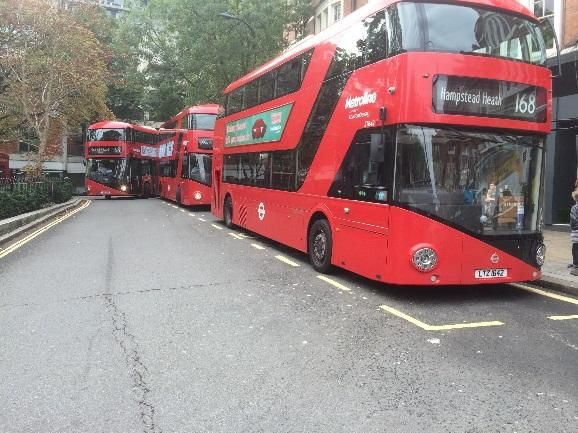 A double decker buses parked on a street Description automatically generated
Bus stands in South End Road, on either side of South End Green
Improvements to the London Overground service substantial volumes of passengers using Hampstead Heath station. The Office of Rail Regulator’s report for 2022/23 records the annual number of journeys to and from Hampstead Heath at 2.9 million (3.3 million in 2014/2015), only 700,000 less than Hampstead Underground Station at 3.6 million (4.3 million in 2015). Many passengers commute to work at the Royal Free Hospital. Others make use of Hampstead Heath station to visit the Heath and surrounding open spaces. The introduction of a large M&S foodstore has drawn yet more people to this centre.
Substantial public realm investment is therefore required to enable South End Green to cope with these large pedestrian movements, to ensure spaces are permeable and to remove the barriers that make the pedestrian experience an unhealthy and frustrating one.
While South End Green has for many years been a transport hub, significant problems are being caused by its use also a bus terminus/standing area and the volumes of buses and people have now reached such levels that this model is unsustainable.
Community engagement confirms that a shared use scheme and the reconfiguration of bus stands would be welcomed for South End Green. The Plan encourages Camden Council to work with partner organisations and Transport for London to help realise the community’s vision for the area.
 Economy
Introduction
It is vital for Hampstead’s future that it retains a flourishing local economy that attracts businesses and creates jobs. This section seeks to build policies that will nurture and protect the local economy.
A very important reason for assuring the future of businesses in Hampstead is to meet the varied needs of local residents. The NPPF, in section 7, urges local plans to promote competitive town centres that provide customer choice and which reflect the individuality of town centres.
The Covid pandemic from 2020 onwards forced a shift of work to homes, which in many cases has yet to be reversed. This makes it more important to ensure that local residents’ needs are being met. However, retailers face the old challenges of high business rents and rates, and the more recent advent of online shopping.
The Hampstead Neighbourhood Forum area contains two important retail centres: the centre of Hampstead itself, and the South End Green area. Each are briefly described below.
Hampstead Town Centre is the second smallest of Camden’s six retail centres but one of the most attractive to visitors and residents alike. Many visitors come from outside the area, attracted by the “village feel”, the proximity of the Heath and the many restaurants and cafes.
Visitors also come for essential shopping, and there are independent butchers, greengrocers, bakers and off-licences that offer a high-quality range of food and drink. Perhaps as a result of high rates and rents, the majority of retailers cater for the high end of the retail market.
In 2021, the Hampstead Neighbourhood Forum carried out a survey intended to discover residents’ attitudes to the high street areas in light of the Covid pandemic, as well as residents’ views of these areas. At that time, a significant number of businesses had closed, but there were also quite a number of new arrivals.
While there were some concerns about the make-up of the retail offering, the survey found a high level of satisfaction: “Those concerned about imbalances in the retail offering were far outweighed by those who commented positively on the range of shops, cafés, restaurants, food stores and pubs in Hampstead. Residents commended the village atmosphere, the sense of community and belonging, as well as the beauty, charm, leafiness and historic heritage. They appreciated having, with easy walking distance, independent shops selling fresh produce. They liked the buzz and liveliness, the easy availability of public transport and the proximity of Hampstead Heath.”
The chief concern of residents was traffic, with associated air pollution. There was also unhappiness about litter and uncollected rubbish. In addition, “the balance between chain and independent shops was seen by many as skewed too far towards the former.”
The pandemic seemed to accelerate the pace of change in the retail offering. Research by the Hampstead Neighbourhood Forum found that in the two years after lockdown was imposed on 23 March 2020, 33 retail and hospitality businesses closed within the Forum area. In the same period, 28 businesses opened (including the Magdala and Old White Bear pubs, which reopened after long absences). Since March 2022, the rate of change has continued to be brisk, with a further 21 businesses closing by June 2023, more than balanced by the arrival of 23 businesses, with a few more known to be opening in the near future. These figures indicate the overall health of the high street areas remains quite robust, with departures broadly balanced by new arrivals. Many individual businesses found themselves in difficulties at the onset of the pandemic, and a number of sites have been empty for long periods, especially on Hampstead High Street. However, the pandemic did not precipitate a crisis for the Hampstead’s retail centres as a whole.
According to the Forum’s survey of residents, a further effect of the pandemic seemed likely be a permanent change in working patterns. Nearly a third of Hampstead residents were expecting to spend more time operating from home than they did before the pandemic. This led to a belief that the high street areas would need to provide services to support home working, such as places for meeting and co-working, and office supply and IT shops.
For the future, residents wanted a greener Hampstead, with curbs on car use and more pedestrianised streets. They wanted more spaces for community and cultural activities.
At the heart of the South End Green Neighbourhood Centre stands the impressive 1881 Gothic Revival drinking fountain located in part of what remains of the “green.” The parades of shops provide essential shopping and services, especially to the nearby neighbourhoods of South Hill Park and the Mansfield area. They also service the thousands of workers and visitors brought to the area by the Royal Free Hospital and Hampstead Heath.
Small independent shops, delicatessens, convenience stores, pubs, cafes and restaurants make up the majority of the retail units, though a number of chains also have a presence. There is a broad range of retailers, such as hairdressers, dry cleaning, shoe repair shops, locksmiths and businesses such as undertakers, estate agents and a betting shop; however, there is no bank branch or post office.

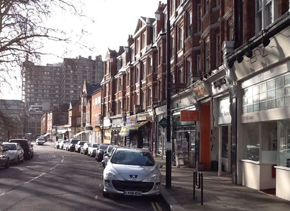
Policy EC1: Encouraging a healthy retail mix
The Plan supports sustainable development that helps retain jobs and encourages a vibrant mix of shops and services.
Since the 2018 Hampstead Neighbourhood Plan took effect, new government regulations have removed distinctions between different classes of high street businesses (A1, A2 etc) and have placed most within a new Class E. Changes within this class are now considered permitted development and need no planning permission. However permission may still be required for changes from Class E to Class C3 (dwellinghouses) as Camden has introduced an Article 4 Direction withdrawing some permitted development rights.
Commercial premises, once converted to homes, are likely to stay in residential use. This is likely to reduce the economic dynamism of the area, reducing jobs and narrowing the commercial offering. For example, in both centres, many first-floor premises are homes to dentists, gyms, solicitors’ offices and other businesses.
Camden, alert to the dangers of a loss of dynamism in high street areas, has developed a “Future High Streets” prospectus with an agenda for building community hubs that promote cultural and other activities.
One factor in the health of Hampstead’s retail businesses is the existence of businesses located in the spaces directly above shops. The people who work in businesses in Hampstead are customers for other businesses, such as restaurants and cafes.
South End Green lost its post office in 2008. Post offices — or sub post offices — provide easy public access to essential services including mailing, access to cash and retail goods. The Plan would support a business opening a sub post office in the SEG area.
Policy EC2: Retail centre environment
The appearance of a high street is one of the key factors in its vitality. Despite existing guidance, many inappropriate and poorly designed shopfronts have been inserted into existing frames. Some fascias use inappropriate materials and depths, resulting in a lack of harmony with the original buildings, quite a number of which are listed.
The Plan supports the development of shopfronts in the Hampstead Town Centre and South End Green Neighbourhood Centre that contribute positively to the character and visual quality of their surroundings.
External illumination of signs is generally preferable; it should be discreetly fixed and the minimum to allow the sign to be seen at night. The colour and brightness of the illumination and its ability to distract or confuse passing drivers will be considered. The size of lettering and logos should be in proportion to the detailing of the building.
The house style of multiple stores will often not be acceptable as they generally involve the use of designs and materials not visually related to, or developed from, the conservation area context.
On 19th century buildings, a painted timber fascia with painted lettering or letters in another material would be the most appropriate.
Temporary banners should not be employed as a long-term substitute for permanent signage.

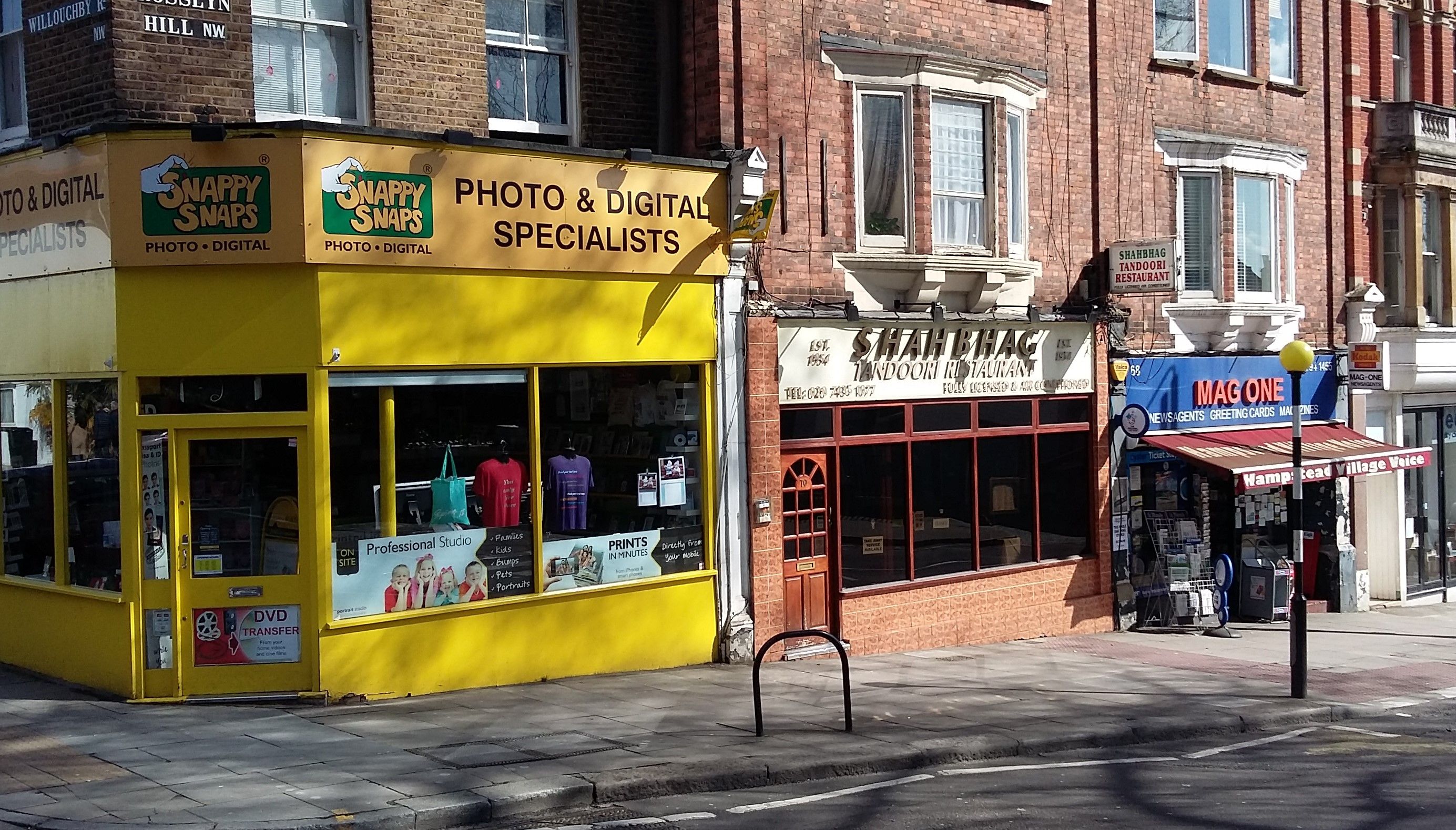 The Plan encourages
shopkeepers to keep windows of shopfronts clear of posters and signs
that create visual clutter. Camden Planning Guidance 1 and the
Conservation Area Appraisals and Management Strategies provide further
details on shopfront guidance.
The Plan encourages
shopkeepers to keep windows of shopfronts clear of posters and signs
that create visual clutter. Camden Planning Guidance 1 and the
Conservation Area Appraisals and Management Strategies provide further
details on shopfront guidance.
Inappropriate use of materials and unsympathetic treatment of details
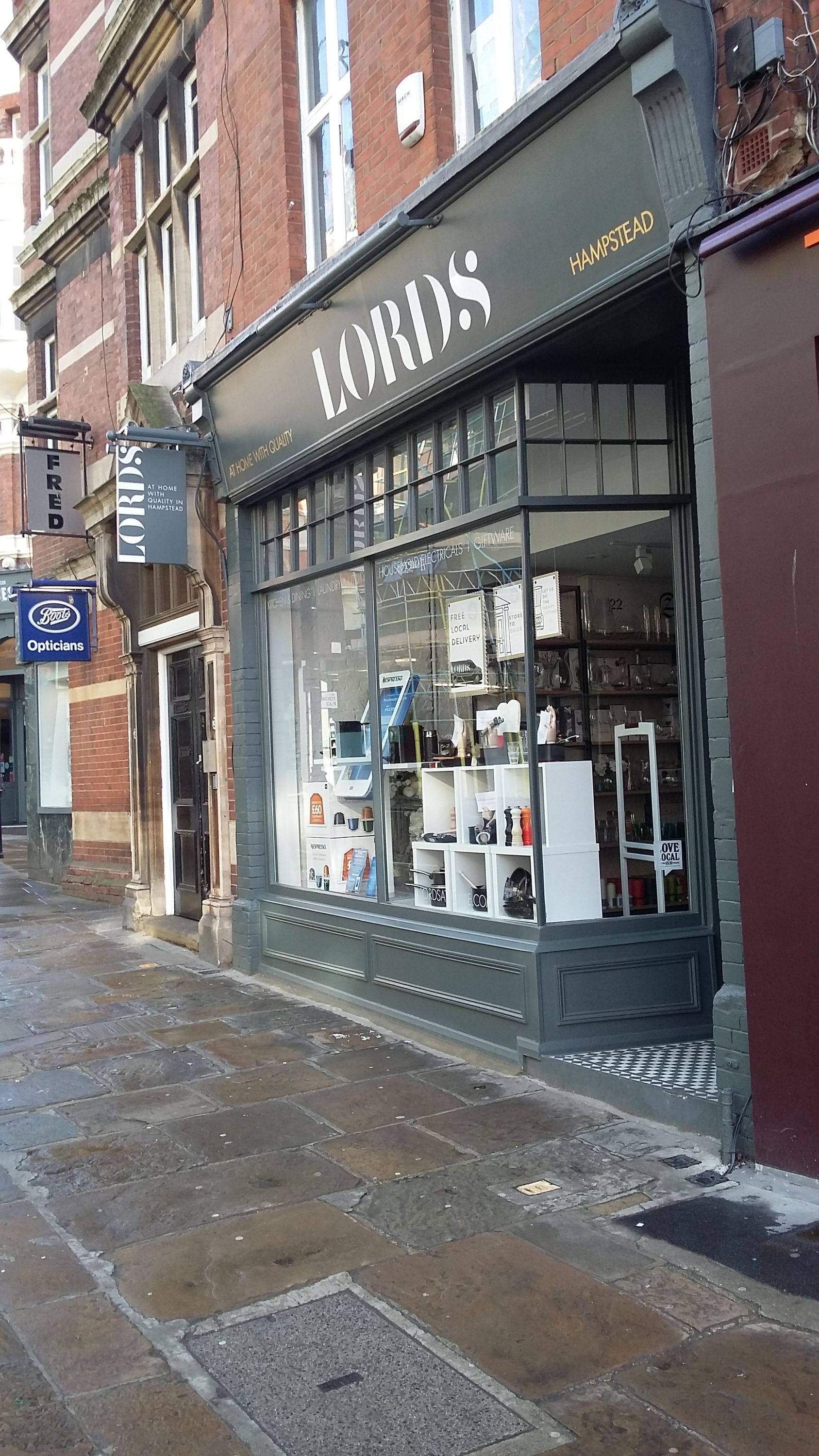
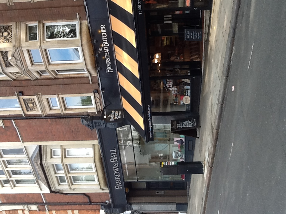
Good examples respect the scale, style and materials appropriate to the buildings’ architecture and provide attractive settings for the display of goods.

Introduction
Hampstead’s community is as diverse as its architecture.
Throughout our consultations, people talked about the importance of Hampstead’s sense of community, of its rich cultural heritage and diversity and the value of its local amenities.
The Plan aims to enhance Hampstead’s cherished village-like character by protecting important community assets and supporting developments that will improve the quality of life for all of its residents, including a wide range of cultural activities.
The value of local housing stock has risen greatly over recent decades and is beyond the means of most people. In 2014, the mean house price in Hampstead Town Ward was £1.75 million, an increase of 250% over 10 years (compared to an average Camden increase over the same period of 173.6%). Over the 12 months to April 2023, the average sale price of a terraced house in the NW3 postcode was about £2.2 million (using figures from the Rightmove and Zoopla websites). The average sale price of a flat was above £900,000.
Given the concomitant rise in the cost of living, the cohesiveness and diversity of the area may be suffering. Only a handful of social housing properties become available in any one year. The amount of social housing in the forum area is very low: Camden’s Local Plan Policy H7 identifies a shortage of large dwellings in the social affordable sector. In the Plan area, both the loss of small dwellings and the combination of large dwellings have resulted in more expensive housing.
Policy HC1: Housing mix
The Plan supports Camden’s policy aimed at minimising dwelling loss during conversions. Paragraphs 3.75-3.78 of the Camden Local Plan outline when such losses by be acceptable.
Policy HC2: Community facilities
Facilities servicing older residents are particularly important. Hampstead has a higher percentage of older residents than the rest of Camden and this age group is growing. In 2011, over-60s accounted for 22% of the population, versus 19% in 2001 (comparable figures for Camden were 15.1% and 14.2%). Those over 75, rose from 6.8% to 8.2% in the same period while residents aged 16-29 declined from 21.5% to 15.4%.
However, a number of facilities in the Plan Area serving older and vulnerable people have been sold off in recent years and have not been replaced locally.
The area has a number of community facilities that are widely used, appreciated and which support the community’s needs. Development of these facilities to improve access, accommodation and range of services will generally be supported.
The Plan supports ways to increase the use and the availability of the above-listed assets to the wider community; for example, increasing the use of school facilities outside school time. Many of the area’s places of worship offer diverse cultural programmes and venues for community activities, which the Plan also supports.
The Plan encourages regular consultation with businesses and the local community to update the CIL priority lists for the Plan Area.
Should the Hampstead Post Office site be re-developed, the Plan would urge any developer to retain a facility for post office functions. According to a 2020 Post Office study, a post office in a high street is an important driver for local business and acts “as an important backstop for those that cannot access cash, mail or digital services elsewhere.”

Policy HC3: Enhancing street life
As articulated in the London Plan, the quality of the public realm significantly influences people’s quality of life, affecting people’s sense of place, security and belonging, as well as having an influence on a range of health and social factors.
The London Plan (7.16) states that buildings that frame public and private open spaces “should contribute to the highest standards of comfort, security and ease of movement.
The Plan encourages street life though better design of the public realm, which would facilitate community events such as festivals, fairs, street parties and other cultural activities.
The Plan also supports regular closure of selected streets and squares to traffic to facilitate markets, festivals, children’s play, etc.
These appendices can be found on www.camden.gov.uk
1 Evidence base
2 Character areas
3 List of designated and non-designated heritage assets
4 Open Spaces and Biodiversity Corridors
5 Hampstead Local Green Spaces evidence
6 List of veteran and important local trees
7 List of important local views


